
 Meher Baba's Life & Travels
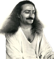


* There are no photos of Meher Baba taken at this location on his visit.
http://www.cotswolds.info/places/chippenham.shtml
http://www.visitwiltshire.co.uk/site/around-wiltshire/towns-and-villages/chippenham
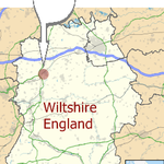
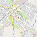


Coordinates: 51.4585°N 2.1158°W

| Chippenham | |

Chippenham
|
|
| Population | 42,060 [1] |
|---|---|
| OS grid reference | ST919733 |
| Unitary authority | Wiltshire |
| Ceremonial county | Wiltshire |
| Region | South West |
| Country | England |
| Sovereign state | United Kingdom |
| Post town | CHIPPENHAM |
| Postcode district | SN14,SN15 |
| Dialling code | 01249 |
| Police | Wiltshire |
| Fire | Wiltshire |
| Ambulance | Great Western |
| EU Parliament | South West England |
| UK Parliament | Chippenham |
| List of places: UK • England • Wiltshire | |
Chippenham is a market town in Wiltshire, England, located 21 km (13 mi) east of Bath and 163 km (101 mi) west of London. In the 2001 census the population of the town was recorded as 28,065[2], however, Council projections for 2009 estimate the population at 42,060.[1]
The town was established on a crossing of the River Avon and is believed to have existed as some form of settlement since before Roman times. It was a royal vill, and probably a royal hunting lodge,[3] under Alfred the Great. Kings lodge school, a primary school in Chippenham was named after King Alfred's Hunting lodge. The town continued to grow when the Great Western Railway arrived in 1841, and while historically a market town the economy has changed to that of a commuter town.
Chippenham is twinned with La Flèche in France and Friedberg in Germany. The town motto is "Unity and Loyalty".
Contents[hide] |
[edit] Geography
[edit] Situation
Chippenham is set on a prominent crossing of the River Avon and lies between the Marlborough Downs to the east, the Cotswolds to the north and west and Salisbury Plain to the south.
The town is surrounded by sparse countryside and there are several woodlands in or in close proximity to the town, for example, Bird's Marsh, Vincients Wood and Briars Wood.
[edit] Suburbs
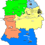
Suburbs of Chippenham include Cepen Park (North & South), Pew Hill, Monkton, Pewsham, Frogwell, Hardenhuish, Rowden Hill, Derriads, Lowden, The Folly, Redlands, Queen's Crescent, Lackham, Fenway Park, and Hill Rise; these loosely correspond to local government wards.
[edit] Transport


Chippenham lies 7 km (4.3 mi) south of the M4 motorway, which links the town to Bristol, Swindon, South Wales and London. The A4 former coach road, A420 and B4069 provide further road links to Bath, Bristol and Oxford. The town is bypassed to the west by the A350, which links the M4 motorway with Chippenham and nearby towns to the south, such as Melksham and Trowbridge. The A4 national route crosses the southern part of the town, and residents have called for an eastern extension linking the A4 to the A350 north of Cepen Park.[4]
Chippenham railway station is on the main line rail route and an important junction between London Paddington to the West Country and is famous for its railway arches and other buildings engineered by Isambard Kingdom Brunel as part of the Great Western Railway development. It is served by main line services and a smaller service towards Southampton. It is being electrified to make train times faster from London to the West Country. National Coach services connect at Chippenham to London, Wales, South West England, the Midlands and East Anglia. Bus and minibus services connect the town to Bath, Calne, Devizes, Trowbridge, Swindon, and nearby villages.
[edit] Landmarks

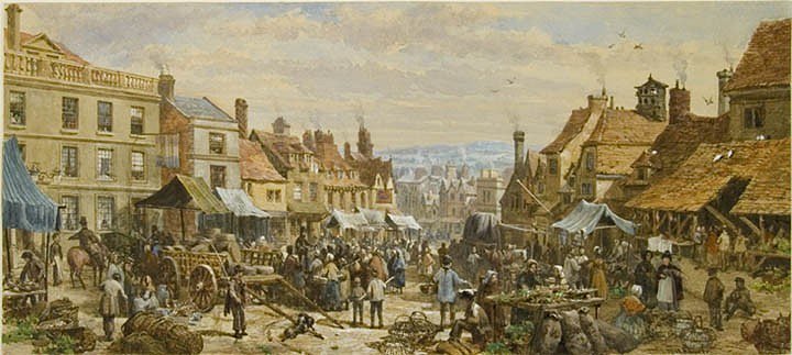
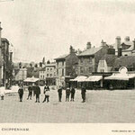
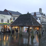
The original Buttercross, a stone structure, was erected in c. 1570 and stood in the current location of Barclays Bank, where it served as the centre of the Shambles. The Buttercross was used for the sale of meat and dairy products. In 1889 Mr E.C. Lowndes bought the Buttercross for £6. He re-erected it as a gazebo in the kitchen garden of the Castle Combe Manor House, where it subsequently fell into disrepair. The Buttercross was re-erected in 1995 by the Chippenham Civic Society with funding provided by a wide range of local individuals and organisations. It currently stands as the centre-piece of the pedestrianised area of the town centre, where a market is held each Friday and Saturday.[5]
The Yelde Hall is currently the site of the Tourist Information Centre in Chippenham. It is run jointly by Chippenham Town and North Wiltshire District Councils and is the largest Tourist Information Centre in North Wiltshire. The hall is one of very few remaining medieval timber framed buildings in the town. It was originally divided up internally for use as a market hall. Both the hall and its meeting room upstairs were used by the burgess and bailiff for a variety of meetings and trials as well as being used for Council meetings. The space under the Council Chamber was used as the town gaol. The hall was also used in this time for fund raising events for the local church. After the Council and Burgess (now Mayor) moved to the Town Hall (High Street, Chippenham) in 1841 the hall had many different uses:
- Chippenham Savings Bank
- Chippenham Volunteer Rifle Corps (stationed in Chippenham from 1846 to 1911)
- Chippenham Fire Station (from around 1910 until 1945 when they moved to their current location in Dallas Road) this led to substantial changes to the interior structure to accommodate the engines and the addition of two large doors to the end gable
- Chippenham Museum (the Borough Council started work on this in the 1950s but the museum didn't open until 25 October 1963. The museum outgrew the site and closed in this location in 1999)
- North Wiltshire Tourist Information Centre (since March 2003 following substantial restorations)[6]

[edit] Bird's Marsh
Bird's Marsh is a large woodland, approximately 24 hectares (59 acres) in size, to the north of the town. It is home to many kinds of wildlife, and a popular place for walkers, due to its fairly large size and surrounding countryside. One entrance into Bird's Marsh can be found through a field close to the Morrisons supermarket, just south of the roundabout on the A350 Malmesbury Road. There are also access points off Hill Corner Road (via fields) and Jacksom's Lane. Although not technically a marsh, the ground can be very boggy off the well-marked paths, a feature which has protected this area from housing development.
In 2008, developers made a planning enquiry about building 800 homes around the Bird's Marsh area.[7][8]
[edit] Climate
| [hide]Lyneham climate: Average maximum and minimum temperatures, and average rainfall recorded between 1971 and 2000 by the Met Office. | ||||||||||||||
|---|---|---|---|---|---|---|---|---|---|---|---|---|---|---|
| Month | Jan | Feb | Mar | Apr | May | Jun | Jul | Aug | Sep | Oct | Nov | Dec | Year | |
| Average max. temperature °C (°F) |
6.6 (43.9) |
6.9 (44.4) |
9.4 (48.9) |
12.0 (53.6) |
15.7 (60.3) |
18.5 (65.3) |
21.2 (70.2) |
20.7 (69.3) |
17.7 (63.9) |
13.6 (56.5) |
9.6 (49.3) |
7.4 (45.3) |
13.3 (52.9) |
|
|
Average min. temperature °C (°F) |
1.2 (34.2) |
1.0 (33.8) |
2.6 (36.7) |
3.7 (38.7) |
6.7 (44.1) |
9.7 (49.5) |
11.9 (53.4) |
11.8 (53.2) |
9.8 (49.6) |
6.8 (44.2) |
3.7 (38.7) |
2.1 (35.8) |
6.0 (42.8) |
|
|
Rainfall mm (inches) |
70.1 (2.8) |
50.6 (2.0) |
58.3 (2.3) |
47.7 (1.9) |
51.8 (2.0) |
58.5 (2.3) |
47.2 (1.9) |
56.1 (2.2) |
63.9 (2.5) |
70.4 (2.8) |
66.9 (2.6) |
77.4 (3.0) |
719.0 (28.3) |
|
| Ave. Precipitation (Days) | 17 | 15 | 13 | 13 | 13 | 14 | 15 | 14 | 14 | 15 | 17 | 17 | 177 | |
| Ave. Sunshine (Hours) | 31 | 56 | 93 | 130 | 186 | 180 | 186 | 150 | 120 | 93 | 60 | 31 | 1316 | |
| Source: Met Office[9] | ||||||||||||||
[edit] Population and demographics

Chippenham's population has grown rapidly in recent years to 28,065 (2001 census), an increase of 11% from the 1991 figure of 25,376.[1] This rapid expansion can be attributed to the development of large housing estates (indeed, entirely new suburbs) such as the vast Cepen Park
district to the west of the town, and the Pewsham development to the east (Pewsham is also the name of a small village just to the east of Chippenham). Further housing developments are also
currently progressing, though on a smaller scale. Chippenham's population in 2007 was estimated at about 35,000 inhabitants.[10] According to Wiltshire Council population projections for 2009 was estimated at
42,060, making Chippenham the highest town population in Wiltshire.[1]
[edit] History
There are believed to have been settlements in the Chippenham region since before Roman times. Remains of Romano-British settlements are visible in the wall behind the former magistrates court and recent redevelopments of the town have shown up other evidence of the earliest settlements.[11]
[edit] Toponymy
The town proper was believed to have been founded by Anglo Saxons around 600. The Anglo-Saxon Chronicle records the town as Cippanhamme and this could refer to Cippa who had his Hamm, an enclosure in a river meadow. An alternative theory suggests that the name is derived from the Anglo-Saxon word Ceap, meaning market.[12][13] The name is recorded variously as Cippanhamm (878), Cepen (1042), Cheppeham (1155), Chippenham (1227), Shippenham (1319) and Chippyngham (1541).[14] On John Speed's map of Wiltshire (1611), the name is spelt both Chippenham (for the hundred) and Chipnam (for the town itself). (There is another Chippenham, Cambridgeshire and Cippenham, Berkshire near Slough).
[edit] Early Medieval
In AD 853, Ethelswitha (sister to Alfred the Great) married the King of Mercia in Chippenham. Alfred was then a boy of four and the wedding is believed to have been held on the site of St. Andrew's church. According to Bishop Asser's Life of King Alfred Chippenham was, under Alfred's reign, a royal vill;[15] historians have also argued, from its proximity to the royal forests at Melksham and Barden, that it was probably a hunting lodge.[3] Alfred's daughter was also married in Chippenham.[16]
Chippenham was successfully besieged by Danish Vikings in 878, though Alfred escaped. Later that year Alfred decisively defeated the Danes at the Battle of Ethandun, whose forces then surrendered to Alfred at Chippenham (ushering in the establishment of the Danelaw).[13]
In 1042 the Royal holding in Chippenham makes mention of a church.[13] The Domesday Book listed Chippenham as Cepen, with a population of 600-700 people in 1086.
[edit] High and Late Medieval
In Norman times the Royal properties were separated into the manors of Cheldon, Rowden and Lowden. Records show that the town expanded into Langstret (now the Causeway) from 1245 onwards and in 1406 onwards the town pushed into Le Newstret (now the New Road) area of town. Throughout this period Chippenham continued to have a thriving market in the town centre.
The A4 that runs through Chippenham (from London to Bristol) incorporates parts of the 14th century medieval road network that linked London to Bristol through Chippenham. This was an important road for the English cloth trade and its upkeep was funded in part by cloth merchants from Bristol due to its importance to the trade.[16]
Chippenham was represented in the Parliament of England from 1295 onwards and Queen Mary granted the town a Charter of Incorporation in 1554.

Analysis of the wood used to build the Yelde Hall indicates that the market hall was built after 1458. The Shambles and Buttercross were built after 1570.[11] The Shambles were destroyed in a fire in 1856 and the Yelde Hall survived.[17]
The parish of Chippenham Without encompasses the deserted medieval village of Sheldon, devastated by plague; all that remains today is Sheldon Manor, Wiltshire's oldest inhabited manor house, dating from 1282.
[edit] 16th to 18th centuries
The wool industry took off in the 16th century due, in part, to the river. The plague hit the town hard in 1611 and 1636. This, a recession in the woollen industry, and a drop in corn production in 1622 and 1623, caused massive hardship for the town's population. The trade in cloth faced further problems during the English Civil War due to a Royalist proclamation that prohibited the sale of cloth to the Parliamentarian controlled London.
In 1747 a bribery and corruption scandal (involving two members of parliament for Chippenham) led to the downfall of Sir Robert Walpole's government.

[edit] 19th and 20th centuries
A spur off the Wilts & Berks Canal was built to Chippenham in 1798 with a wharf at the current site of the bus station (Timber Street) with the main commodity traded being coal. Pewsham Way now follows the line of the old canal. The Great Western Railway arrived in Chippenham in 1841 which in turn attracted many new businesses to Chippenham. The arrival of these businesses required new housing which led to the expansion of Chippenham into the land north of the railway line, which in turn led to the growth of further industries to support the building work.
The arrival of the railway promoted the growth of industrial agricultural businesses. In the middle of the 19th century Chippenham was a major centre for the production of dairy and ham products; this led, later, to Nestle and Matteson's to have factories in the town centre. The railway also led to the growth of railway engineering works in Chippenham. The first of these was Roland Brotherhood in 1842. A variety of companies then took over part or all of the business on the site until in 1935 Westinghouse Brake and Signal Company Ltd took over the business site fully. [11] The signalling side of the business remains at the Chippenham site and is now owned by Invensys Rail Group; the brakes business was taken over by the German company Knorr-Bremse [18], and is based at a site in nearby Melksham.

The singer Eddie Cochran and Gene Vincent were involved in a car crash in Chippenham on 17 April 1960 on Rowden Hill. Cochran died as a result of the crash.[17] A memorial sits near the crash site and Chippenham hosts an Eddie Cochran festival annually (see below).
On 13 February 1998, two unexploded bombs from World War II were discovered in the field behind Hardens Mead during preparations for the building of Abbeyfield School. About 1,100 residents living in the east of Chippenham had to be evacuated for two nights to friends and relatives or emergency accommodation until the Army carried out a controlled explosion.[17] The Army initially attempted to defuse the larger 750 kg (1,700 lb) device but it was decided that owing to the bomb's orientation in the ground it would be too dangerous.[19]
[edit] Governance
The offices of North Wiltshire District Council were based in the town until 2009, when the council was merged with four other Wiltshire local authorities. The offices in Monkton Park were adopted by the replacement unitary Wiltshire Council, which is based in Trowbridge.
The office of Town Mayor was established in 1835: prior to that Chippenham was governed by a Bailiff supported by Burgesses. The Mayor is nowadays elected annually by the Town Council The Mayor is generally appointed to office in May of each year (at the "Mayor Making" ceremony) and acts as the first citizen of the town acting in a promotional way representing Chippenham. At the beginning of a Mayor's term of office he/she names a charity that they will support throughout the year. The Mayor also undertakes many specific tasks throughout the year such as presiding over Town council meetings and acting as the President of a variety of local organisations such as the Twinning Association and the Sea Cadets.[6] The current Mayor is Mr David Powell (Liberal Democrat)[20]
Until 2010, the town of Chippenham was within the parliamentary constituency of North Wiltshire. North Wiltshire, which was also known as Chippenham, is a traditionally Conservative seat although in the 19th century, Liberal members were also elected. In 1812 Sir Robert Peel became the MP for Chippenham.
Boundary changes for the 2010 general election created a new Chippenham constituency from parts of three neighbouring constituencies. Duncan Hames (Liberal Democrat) became the new Member of Parliament for Chippenham, and James Gray (Conservative) was re-elected in his North Wiltshire constituency,
[edit] Culture

The Chippenham Folk Festival[21] takes place every year, usually over the Whitsuntide weekend.
The town holds an annual festival in remembrance of American rock and roll singer Eddie Cochran, who tragically died on 17 April 1960 following a car accident shortly before midnight the previous day, while travelling through Chippenham on his way back to London during a British tour. Singer Gene Vincent and songwriter Sharon Sheeley survived the accident.
From 25 October 1963 until 1999, the Town Museum was housed in the Yelde Hall. It had, by this time, outgrown the site and moved to the former Magistrates' Court in the Market Place (opening on 23 March 2000). The museum charts the history of the town from Neolithic times until today. By 2005, the museum had attracted over 90,000 visitors.[6]
[edit] Sport and leisure

Chippenham is well served with sports clubs and leisure facilities. The Olympiad Centre caters for a wide range of interests and has a variety of swimming pools and full gym facilities.[22] It also plays host to many events including the popular annual CAMRA beer festival.[23]
Chippenham Sports Club[24], located on the Bristol Road, is a members sports club. Its facilities include a two storey pavilion that overlooks the six hard surface floodlit tennis courts and the cricket square and field.[25] A recently built bowls[26] pavilion accompanies the best bowling green in the county which plays host to the Wiltshire Middleton Cup Team. The all weather hockey pitches support thriving Ladies' and Men's teams. Due for completion in May 2009, an all year round, indoor sports inflated dome that will provide much needed amenities including netball, cricket nets plus a 5-a-side football league to name but a few.
Next door to the sports club is Chippenham Town F.C.[27] The football club was established in 1873, and played in the 2000 FA Vase final, the last ever at the old Wembley Stadium. Their manager, Thomas Saunders, at the age of 28, was the youngest to lead a side in an FA final. They play in the Southern Premier League, the seventh hightest tier of English football. Chippenham Rugby Club is on the western outskirts next to the A350 bypass.[28] Chippenham Golf Club[29] is situated on the A350 as it leads North from the town. The club, formed in 1896, is currently undergoing contruction of a new clubhouse and redeveloped course.
Chippenham has a small cinema, the Reel Astoria, on the A420 West of the town centre. The town has been identified as an ideal location for a multiplex cinema which could serve an area covering Calne, Melksham, Corsham and Malmesbury, towns currently devoid of cinemas, eliminating the need for travel to congested Bath or further-afield Swindon.
The Severn and Thames cycle route (part of Route 4) of the Sustrans National Cycle Network passes through the town.
There is a variety of night life: including clubs E11vens and Karma (currently awaiting the outcome of an appeal against closure), Jax Landing, a wine bar, and pubs including The Brunel, The Bridge House, The Pheasant Carvery, The Rose & Crown and Little George, although many people prefer to travel to nearby Bath, Swindon or Bristol.
[edit] Economy

Historically a market town, Chippenham's economy has since changed to that of a commuter town with residents travelling to workplaces in Bath, Bristol, Swindon and even London (almost 100 miles to the east).
Several large businesses have been located in the region, with the biggest former employer being Westinghouse, now owned by Invensys, whose factory complex lies next to the railway station. The company undertakes railway signalling contracts for Network Rail, London Underground as well as railway operators is other parts of the world, e.g. Beijing Subway, Oslo Public Transport Administration, SMRT Corporation, Kowloon-Canton Railway Corporation, MTR Corporation and many others. Parts of the Westinghouse site are occupied by a range of companies. There are a number of other industrial sites around the town, Bumpers Farm being the largest. It is home to many businesses of all sizes, including IT Solutions Ltd(ITS), CPI Antony Rowe Ltd.[1][2], Bechtle Direct Ltd, The Web Usability Partnership Ltd, De Marchi Engineering, Multiquip, Blade, Chippenham Accident Repairs, Bathwick Tyres, LF Windows, Avon Rubber, "Home James" taxis and Norman E Webb.
In 2005, Europe's second largest logistics organisation, Wincanton PLC, consolidated its head office operations and moved to the newly developed Methuen Park office development in west Chippenham, where it employs around 350 people.
[edit] Shopping
Chippenham's major retail area surrounds the pedestrianised High Street and Market Place, which consists of numerous shops of various categories. Two shopping centres lie on either side of the High Street; the enclosed Emery Gate Shopping Centre and the open air Borough Parade Shopping Centre [3]. Of all the shops in the High Street and nearby alleys there are very few independent stores as franchises dominate, however some independent stores (Jewellers, Nail Bars, Florists, Bridal Gowns, Hairdressers) are located along The Causeway and the Upper Market Place.
Retail parks, such as the Hathaway Retail Park, are located on the edge of town containing larger superstores and fast-food outlets, including a McDonalds and a small Burger King.
Local shoppers founded Chippenham Co-operative Society in 1890, and for most of the twentieth century, its department store dominated the lower end of the High Street. The building now is occupied by a large Wilkinson shop. In the 1960s, it united with other co-operatives in the district to merge with a national co-operative, that later formed The Co-operative Group. As of 2008, the co-operative operates a convenience store in the Broomfield district.[30][31]
[edit] Market
Chippenham is a market town, with street markets taking place most Fridays and Saturdays around Market Place and along the pedestrianised High Street. A Farmers' Market for the sale of fresh, locally produced foodstuffs is also held here once a fortnight.[32] The original Cattle Market, which closed in 2004, is now being redeveloped by Linden Homes Western Limited as one of the UK's largest eco-housing projects.
[edit] Tourism
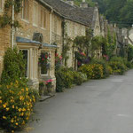
Surrounding the town are a number of stone-built villages, including Lacock (National Trust), Biddestone, Bremhill and Castle Combe. The great house and art treasures of Longleat, Bowood House, Lacock Abbey, Sheldon Manor and Corsham Court are within easy reach.
[edit] Twinned towns
Chippenham is twinned with La Flèche in France and Friedberg in Germany.
La Flèche lies on the banks of the Loir, 42 km (26 mi) from Le Mans and 72 km (45 mi) from Tours. Set amongst woods and farmland, La Flèche offers a wealth of recreational facilities including a zoological park. "Le Prytane Militaire" public school dates back to the time of the French King Henri IV and consequently La Flèche enjoys the status of a University Town. In 1630, people from La Flèche founded Montreal in Canada.
Friedberg is 64 km (40 mi) from Munich and the Bavarian Alps. Herzog Ludwig the severe and his nephew Conradin founded the town in 1264. The magnificent Town Hall follows the architectural style of Elias Holl's Town Hall, built in 1674, in neighbouring Augsburg. Friedberg is a walled town, renowned for its many sporting and cultural events such as the 17th century Street Festival.
[edit] Religion
|
|
This section is in a list format that may be better presented using prose. You can help by converting this section to prose, if appropriate. Editing help is available. (May 2011) |
In the 2001 census, 76 percent of the population in North Wiltshire defined themselves as Christian, 16 percent said they were of no religion and 7 percent did not state a religion.[33]


[edit] Church of England
- St Andrew's Chippenham parish church is believed to have been built on the site of an Anglo Saxon church. Many features of the present church are Norman (with the chancel arch being completed in c.1120). There are a wide variety of features on the different facets of the church. The church spire was completed in 1633 although the 8 bells currently present were not added until 1734 and the back-lit clock and chimes in 1858. The organ has a case front dating from the 18th century. The church registers date from 1578. There was a Victorian era restoration of the interior of the church in 1875 - 1878 and again in the 1990s.[34]
- St. Nicholas church was built in 1779 and replaced an older medieval church that had previously stood on the same site. The church was designed by John Wood the Elder of Bath. The church registers date from 1730.[35]
- St. Paul's church was built in 1854/5 by Sir Giles Gilbert Scott and was consecrated on 18 April 1855 and has registers dating from then.[36]
- St. Peter's original build started in 1885 and opened on 19 November 1886 as a stone and red brick building. The church was replaced by the current church in 1968. The newer St Peter's is a modern design six sided design, originally with a copper roof (now tiled)and a fibre glass spire and no internal supports.[37]
[edit] Roman Catholic
Saint Mary's Roman Catholic Church was originally situated in Saint Mary's Place and was built in 1855. A new church was built on Station Hill in 1935 which replaced the original on 29 February 1936.[38]
[edit] Non-Conformist
- Central Methodist church was built in 1909 to mark the centenary of Methodism in Chippenham. It was originally called Monkton Hill Methodist Church but was renamed after it joined parishes with that of The Causeway Methodist Church that closed in the late 1980s.[39]
- Chippenham Christian Fellowship
- Dayspring Church for North Wiltshire[40]
- Elim Pentecostal Church[41]
- Emmanuel Evangelical Church was founded in April 2005, and meets at Hardenhuish School on Sundays and other locations during the week. It is affiliated to the Fellowship of Independent Evangelical Churches.[42]
- Ladyfield Evangelical Church is affiliated to the Fellowship of Independent Evangelical Churches.[43]
- Oasis Church, founded April 2004 by Pastors Ralph and Heather Burden of the Assemblies of God, the Oasis Church focuses on younger worshippers, meeting on Saturday evenings and featuring rock-based worship.[44]
- The Old Baptist Chapel opened on 10 June 1804 but was not registered until 1810. The internal baptistry was added in 1818.[45]
- Religious Society of Friends
- The Salvation Army Citadel was originally opened in 1903 in Bath road but was later sold to Pictons, after which the Salvation Army moved into the Co-op hall in Foghamshire.[46][46]
- Sheldon Road Methodist Church was built in 1901.[47][48]
- Station Hill Baptist Chapel was built in 1855.[49][50]
- Tabernacle United Reformed Church was built in 1770 but replaced in 1826 and refitted in 1889. The church had substantial internal renovations in the 1990s.[51][52]

- Closed churches
- Cepen Park Methodist church held services in two local schools and closed in 2005.[53]
- Causeway Methodist Chapel opened in 1896 replacing an older chapel on the same site. The older chapel is believed to have been built in around 1835 and still stands to the rear of the newer building (and served as a school room for it). It closed in the late 1980s although the buildings remain.[citation needed]
[edit] Education
In his will of 1661 a Richard Scott directed that his house in Cooke's Street should be used as a school, and William Woodruffe gave an annuity of £5 in 1664 for the teaching of ten poor boys. In 1713 it was re-opened with a benefaction of £10 per annum for 24 boys.[54]
[edit] Modern
The closest higher education / university-level institution is the University of Bath campus at Claverton Down, situated 19 km / 12 miles to the west of Chippenham.
[edit] Tertiary
The former Chippenham Technical College is now part of the Wiltshire College initiative.
[edit] Secondary
Three secondary schools cater for students from year 7 through sixth form.
- Abbeyfield School, Stanley Lane, a specialist Business and Enterprise College which opened in 2000.
- Hardenhuish School, Hardenhuish Lane. Originally, from 1956, a girls' secondary modern school[55] a specialist Maths, Computing and Science, Hardenhuish Lane; the site also hosts a special educational needs unit. The school has opted to join the new government scheme, and gain its academy status.
- Sheldon School, Hardenhuish Lane. From 1959, a boys' secondary modern school,[56] then a comprehensive from 1975, and now a specialist Science College, Sports College and Language College.[57]
[edit] Primary
There are ten primary schools in the town:[58]
- Charter School - Wood Lane
- Frogwell
- Ivy Lane - Ivy Lane
- King's Lodge - Pewsham estate
- St Mary's R.C. - Rowden Hill
- Monkton Park - Sadlers Mead
- St Paul's - The Oaks
- St Peter's CofE - Lord's Mead
- Redland - Brook Street
- Queen's Crescent - Queen's Crescent
The oldest is Ivy Lane. Westmead Junior School held this record until it closed in 1989. It originally opened in 1858 whilst the infants school opened 50 years later.
[edit] Notable people
- Alfred The Great - King of Wessex
- Roland Brotherhood - railway engineer
- David Bishop (athlete) - track athlete
- Isambard Kingdom Brunel - built the Great Western Railway through Chippenham
- Robert Peel - Prime Minister and police reformer, was MP for a short time
- Francis Kilvert - diarist, born in Hardenhuish and lived in nearby Langley Burrell
- Robin Hobbs - England test cricketer, born in Chippenham, remains Wiltshire's most capped test cricketer
- Wil Hodgson - comedian, winner Perrier Best Newcomer 2004
- Darren Eadie - Former Norwich City Football Club player
- Jeremy Corbyn - Labour Party MP and Stop The War activist