
 Meher Baba's Life & Travels


* There are no photos of Meher Baba taken at this location on his visit.
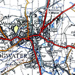
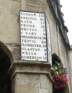
Meher Baba had travelled along the Great West Road ( now the A4 ) on the 13th September 1931, through several towns including Bridgwater, on his way to the retreat at East Challacombe, near Combe Martin and returned back again on the 24th September 1931 to London.


see Bridgewater.
Coordinates: 51°07′41″N 2°59′35″W / 51.128°N 2.993°W / 51.128; -2.993

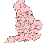
| Bridgwater | |
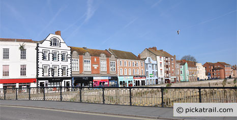
 Corn Exchange, Church of St Mary and statue of Robert Blake |
|

Bridgwater
|
|
| Population | 33,698 [1] |
|---|---|
| OS grid reference | ST305370 |
| Parish | Bridgwater |
| District | Sedgemoor |
| Shire county | Somerset |
| Region | South West |
| Country | England |
| Sovereign state | United Kingdom |
| Post town | BRIDGWATER |
| Postcode district | TA5, TA6, TA7 |
| Dialling code | 01278 |
| Police | Avon and Somerset |
| Fire | Devon and Somerset |
| Ambulance | South Western |
| EU Parliament | South West England |
| UK Parliament | Bridgwater and West Somerset |
| List of places: UK • England • Somerset | |
Bridgwater is a market town and civil parish in Somerset, England. It is the administrative centre of the Sedgemoor district, and a major industrial centre. Bridgwater is located on the major communication routes through South West England. According to the 2001 census, the town had a population of 33,698 .[1]
Bridgwater is situated, on the edge of the Somerset Levels, in a level and well-wooded country, having to the north the Mendip range and on the west the Quantock hills. The town lies along both sides of the River Parrett, 10 miles (16 km) from its mouth, has been a major port and trading centre and maintains a large industrial base. It is linked to Taunton by the Bridgwater and Taunton Canal. Bridgwater is located between two junctions of the M5 motorway and Bridgwater railway station is on the main railway line between Bristol and Taunton.
Historically, the town had a politically radical tendency, being involved in several events of note on the national stage, and was defended by its own castle. The battlefield of the Battle of Sedgemoor, where the Monmouth Rebellion was finally crushed in 1685 is nearby. Among several places of worship the chief is St Mary Magdalene's church. A house in Blake Street, largely restored, was the birthplace of Admiral Blake in 1598, and is now the Blake Museum. The town has its own arts centre and plays host to the annual Bridgwater Guy Fawkes Carnival.
Contents[hide] |
[edit] Etymology
It is thought that the town was originally called Brigg, meaning Quay. It has been argued that the name may instead come from the Old English brycg (gang plank) or Old Norse bryggja (quay), though this idea has been opposed on etymological grounds.[2] In the Domesday Book the town is listed as Brugie, while Brugia was also used. After the Norman invasion the land was given to Walter Douai (a Norman prince), hence becoming known variously as Burgh-Walter, Brugg-Walter and Brigg-Walter, eventually corrupted to Bridgwater. An alternative version is that it derives from "Bridge of Walter" (i.e. Walter's Bridge).[3][4]
[edit] History
Bridgwater is mentioned both in the Domesday Book and in the earlier Anglo-Saxon Chronicle dating from around 800, owing its origin as a trade centre to its position at the mouth of the chief river in Somerset. It was formerly part of the Hundred of North Petherton.[5] In a legend of Alfred the Great, he burnt some cakes while hiding in the marshes of Athelney near Bridgwater, after the Danish invasion in 875, while in 878 the major engagement of the Battle of Cynwit may have been at nearby Cannington.[6]

William Briwere was granted the lordship of the Manor of Bridgwater by John of England in 1201,[4] and founded Bridgwater Friary.[7] Through Briwere's influence, King John granted three charters in 1200; for the construction of Bridgwater Castle, for the creation of a borough, and for a market.[2][8] Bridgwater Castle was a substantial structure built in Old Red Sandstone, covering a site of 8 or 9 acres (32,000 to 36,000 m²). A tidal moat, up to 65 feet (20 m) wide in places, flowed about along the line of the modern thoroughfares of Fore Street and Castle Moat, and between Northgate and Chandos Street. The main entrance opposite the Cornhill was built with a pair of adjacent gates and drawbridges. In addition to a keep, located at the south-east corner of what is now King Square, documents show that the complex included a dungeon, chapel, stables and a bell tower. Built on the only raised ground in the town, the castle controlled the crossing of the town bridge. A 12 feet (4 m) thick portion of the castle wall and water gate can still be seen on West Quay, and the remains of a wall of a building that was probably built within the castle can be viewed in Queen Street. The foundations of the tower forming the north-east corner of the castle are buried beneath Homecastle House.[9] William Briwere also founded St John's hospital[10] which, by the time of the Dissolution of the Monasteries under Henry VIII, was worth the substantial sum of almost 121 pounds,[11] as well as starting the construction of the town's first stone bridge. William Briwere also went on to found the Franciscan Bridgwater Friary in the town.[12]
During the 11th century Second Barons' War against Henry III, Bridgwater was held by the barons against the King. Other charters were granted by Henry III in 1227 (confirmed in 1318, 1370, 1380), which gave Bridgwater a gild merchant which was important for the regulation of trade allowing gild members to trade freely in the town, and to impose payments and restrictions upon others.[4] Bridgwater's peasants under Nicholas Frampton took part in the Peasants' Revolt of 1381,[13] sacking Sydenham House, murdering the local tax collectors and destroying the records.[14]
It was incorporated by charter of Edward IV (1468),[2] confirmed in 1554, 1586, 1629 and 1684. Parliamentary representation began in 1295 and continued until the Reform Act of 1870 when the original borough constituency was disenfranchised for corruption in 1870.[15][16] From 4 July 1870 the town was incorporated within the county constituency of West Somerset. When there was a redistribution of Parliamentary seats to take effect at the 1885 general election, a new county division of Bridgwater was created.[17] A Saturday market and a fair on 24 June were granted by the charter of 1201. Another fair at the beginning of Lent was added in 1468, and a second market on Thursday, and fairs at Midsummer and on 21 September were added in 1554. Charles II granted another fair on 29 December. The importance of these markets and fairs for the sale of wool and wine, and later of cloth in declined after medieval times. The shipping trade of the port revived after the construction of the new dock in 1841, and corn and timber have been imported for centuries.[18]
The 1605 Gunpowder Plot is thought to have been masterminded by Robert Parsons, born in the nearby village of Nether Stowey.[19] To this day Guy Fawkes is celebrated as a local hero during the carnival season, including a grand illuminated procession through Bridgwater town centre, which culminates in the Squibbing.[20]

In the English Civil War the town and the castle were held by the Royalists under Colonel Sir Francis Wyndham, a personal acquaintance of the King. British history might have been very different had his wife, Lady (Crystabella) Wyndham, been a little more accurate with a musket shot that missed Cromwell but killed his aide de camp.[21] Eventually, with many buildings destroyed in the town, the castle and its valuable contents were surrendered to the Parliamentarians on 21 July 1645. The castle itself was deliberately destroyed the following year, while in 1651 Colonel Wyndham made arrangements for Charles II to flee to France following the Battle of Worcester.[18]
Following the restoration of the monarchy, in 1663 the non-conformist Reverend John Norman, vicar from 1647 to 1660, was one of several 'religious fanatics' confined to their homes by Lord Stawell's militia. A large religious meeting house, thought to have been Presbyterian, was demolished and its furniture burned on the Cornhill in 1683.[22] By 1688, matters had calmed down enough that a new chapel, Christ Church, was founded in Dampiet Street, the congregation of which became Unitarian in 1815.[22][23]
In the 1685 Monmouth Rebellion, the rebel James Scott, 1st Duke of Monmouth was proclaimed King on the Cornhill in Bridgwater and in other local towns. He eventually lead his troops on a night-time attack on the King's position near Westonzoyland.[24] Unfortunately surprise was lost when a musket was accidentally discharged, and the Battle of Sedgemoor resulted in defeat for the Duke. He later lost his head in the Tower of London,[25] and nine locals were executed for treason.[18]
Bridgwater became the first town in Britain to petition the government to ban slavery in 1785.[26] In 1896, the trade unionists of Bridgwater's brick and tile industry were involved a number of strikes. The Salisbury government sent troops to the town to clear the barricades by force after the reading of the Riot Act.[27]
A by-election in 1938 enabled the town to send a message to the government and Hitler, when an Independent anti-appeasement candidate, journalist Vernon Bartlett was elected.[28]
In World War II the Bridgwater and Taunton Canal formed part of the Taunton Stop Line, designed to prevent the advance of a German invasion. Pillboxes can still be seen along its length. The first bombs fell on Bridgwater on 24 August 1940, destroying houses on Old Taunton Road, and three men, three women and one child were killed. Later a prisoner of war camp was established at Colley Lane, holding Italian prisoners.[29] During the preparations for the invasion of Europe, American troops were based in the town.[30]
The first council estate to be built was in the 1930s at Kendale Road, followed by those at Bristol Road. The 1950s saw the start of a significant increase in post-war housebuilding, with council house estates being started at Sydenham and Rhode Lane and the former cooperative estate near Durleigh.[31]
[edit] Port of Bridgwater

In the medieval period the River Parrett was used to transport Hamstone from the quarry at Ham Hill,[32] Bridgwater was part of the Port of Bristol until the Port of Bridgwater was created in 1348,[4] covering 80 miles (130 km) of the Somerset coast line, from the Devon border to the mouth of the River Axe.[33][34] Under an 1845 Act of Parliament the Port of Bridgwater extends from Brean Down to Hinkley Point in Bridgwater Bay, and includes parts of the River Parrett (to Bridgwater), River Brue and the River Axe.[35]
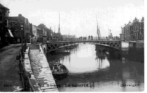
Historically, the main port on the river was at Bridgwater; the river being bridged at this point, with the first bridge being constructed in 1200 AD.[36] Quays were built in 1424; with another quay, the Langport slip, being built in 1488 upstream of the Town Bridge.[37] A Customs House was sited at Bridgwater, on West Quay; and a dry dock, launching slips and a boat yard on East Quay.[38] The river was navigable, with care, to Bridgwater Town Bridge by 400 to 500 tonnes (440 to 550 tons) vessels.[39] By trans-shipping into barges at the Town Bridge the Parrett was navigable as far as Langport and (via the River Yeo) to Ilchester. After 1827, it was also possible to transfer goods to Taunton via the Bridgwater and Taunton Canal at Huntworth.[40] A floating harbour was constructed between 1837–1841 and the canal was extended to the harbour.[41] The harbour area contained flour mills, timber yards and chandlers.[41]
Shipping to Bridgwater expanded with the construction of the docks and reached a peak in the nineteenth century between 1880 and 1885; with an average of 3,600 ships per year entering the port.[41] Bridgwater also built some 167 ships; the last one being the Irene launched in 1907.[42] Peak tonnage occurred in 1857, with 142 vessels totalling 17,800 tonnes (19,600 tons).[43]
Combwich Pill, a small creek near the mouth of the river, had been used for shipping since the 14th century; and a wharf in the 18th century was used for the unloading of coal and the loading of tiles. From the 1830s, with the development of the brick and tile industry in the Bridgwater area, Combwich wharf was used by two local brickyards to import coal and export tiles to Wales and parts of Gloucestershire.[44] This traffic ceased in the 1930s; and in the late 1950s the wharf was taken over by the Central Electricity Generating Board (CEGB) to bring in materials for the construction of the Hinkley Point nuclear power stations.[45] Hinkley Point A nuclear power station being ordered in 1957, with a scheduled completion date of 1960, but was not completed until 1965.[46] This was followed by Hinkley Point B nuclear power station which began operation in 1976.[47]

Dunball wharf was built in 1844 by Bridgwater coal merchants,[48] and was formerly linked to the Bristol and Exeter Railway by a rail track which crossed the A38. The link was built in 1876 by coal merchants, and was originally operated as a horse-drawn tramway. In 1875, the local landowner built The Dunball Steam Pottery & Brick & Tile Works adjacent to the wharf.[49]
Although ships no longer dock in the town of Bridgwater, 90,213 tonnes (99,443 tons) of cargo were handled within the port authority's area in 2006, most of which was stone products via the wharf at Dunball.[50] It is no longer linked to the railway system. The link was removed as part of the railway closures made as a result of the Beeching Report in the 1960s. Dunball railway station, which had opened in 1873, was closed to both passengers and goods in 1964.[51] All traces of the station, other than "Station Road" have been removed. The wharf is now used for landing stone products, mainly marine sand and gravels dredged in the Bristol Channel.[52] Marine sand and gravel accounted for 55,754 tonnes (61,458 tons) of the total tonnage of 90,213 tonnes (99,443 tons) using the Port facilities in 2006, with salt products accounting for 21,170 tonnes (23,340 tons) in the same year,[50] while the roll-on roll-off berth at Combwich is used occasionally for the transfer of heavy goods for the two existing Hinkley Point nuclear power stations. With the possible future construction of the two Hinkley Point C nuclear power stations by EDF Energy, it is proposed that Combwich wharf be employed to transfer heavy goods to the sites.[53] Combwich Pill is the only site where recreational moorings are available in the estuary.[35]
Sedgemoor District Council acts as the Competent Harbour Authority for the port, and has provided pilotage services for all boats over 98 feet (30 m) using the river since 1998, when it took over the service from Trinity House. Pilotage is important because of the constant changes in the navigable channel resulting from the large tidal range, which can exceed 39 feet (11.9 m) on spring tides. Most commercial shipping travels upriver no further than Dunball wharf, which handles bulk cargoes.[35]
[edit] Governance

The Local Government Act 1972 removed the historic status of Bridgwater as a Borough, as it became part of the district of Sedgemoor, which has its headquarters in King's Square.
Bridgwater Town Council was created in 2003,[54] with sixteen elected members representing six wards of the town; Bower (three), Eastover (two), Hamp (three), Quantock (three), Sydenham (three) and Victoria (two). With powers or functions over allotments, bus shelters, making of byelaws, cemeteries, clocks, crime prevention, entertainment and arts, highways, litter, public buildings, public conveniences, recreation, street lighting, tourism, traffic calming, community transport and war memorials.
Bridgwater and West Somerset is a county constituency represented in the House of Commons of the Parliament of the United Kingdom. It elects one Member of Parliament (MP) by the first past the post system of election. The current MP is Ian Liddell-Grainger, a member of the Conservative Party.[55]
[edit] Members of Parliament
The Bridgwater constituency has been represented in Parliament since 1295. After the voting age was lowered in January 1970, Susan Wallace became the first 18-year-old person to vote in the UK,[56] during the 1970 Bridgwater by-election that elected Tom King, who took the title Baron King of Bridgwater in 2001.[57] At the in 2010 it became part of the new Bridgwater and West Somerset constituency.[58]
Residents of Bridgwater also form part of the electorate for the South West England constituency for elections to the European Parliament.[59]
[edit] Twinning
Bridgwater is twinned with Uherské Hradiště, in the Czech Republic (since 1991),[60] La Ciotat in France, Homberg, Efze in Germany,[61] and Marsa in Malta.[62]
[edit] Geography
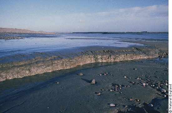
Bridgwater is centred on an outcrop of marl in an area dominated by low-lying alluvial deposits. There are local deposits of gravels and sand.[2] It is situated in a level and well-wooded area, on the edge of the Somerset Levels. To the north are the Mendip range and on the west the Quantock hills. The town lies along both sides of the River Parrett, 10 miles (16 km) from its mouth, which then flows to discharge into the Bridgwater Bay National Nature Reserve. It consists of large areas of mud flats, saltmarsh, sandflats and shingle ridges, some of which are vegetated. It has been designated as a Site of Special Scientific Interest since 1989,[63] and is designated as a wetland of international importance under the Ramsar Convention.[64] The risks to wildlife are highlighted in the local Oil Spill Contingency Plan.[65] On the outskirts of Bridgwater at Huntworth is the Screech Owl Local nature reserve where flooded clay pits provide a roost for thousands of Common Starlings (Sturnus vulgaris) each winter.