
 Meher Baba's Life & Travels
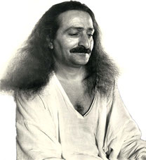


* There are no photos of Meher Baba taken at this location on his visit.
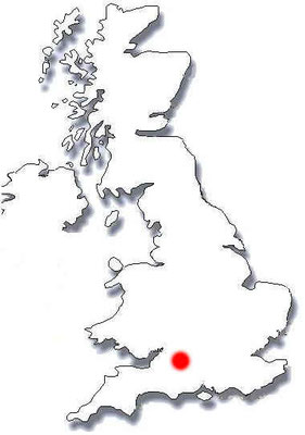
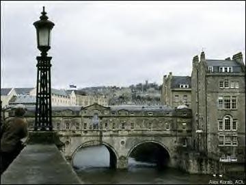
Meher Baba had travelled along the Great West Road ( now the A4 ) on the 13th September 1931, through several towns including Bath, on his way to the retreat at East Challacombe, near Combe Martin and returned back again on the 24th September 1931 to London.


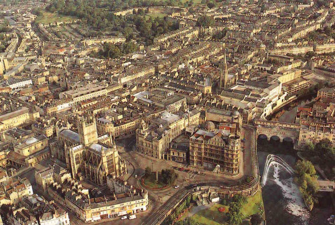


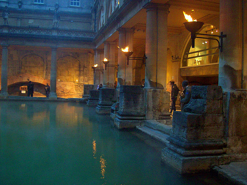
ROMAN BATHS

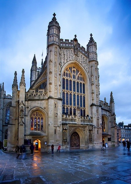
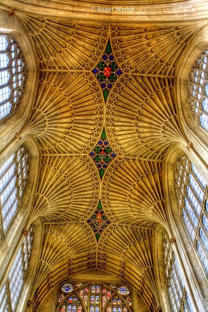
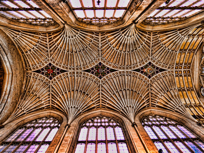
BATH ABBEY

Coordinates: 51°22′51″N 2°21′37″W / 51.3809°N 2.3603°W / 51.3809; -2.3603

| City of Bath | |
 The Royal Crescent in Bath |
|

City of Bath
|
|
| Population | 83,992 [1] |
|---|---|
| OS grid reference | ST745645 |
| - London | 99 miles (159 km) E |
| Unitary authority | Bath and North East Somerset |
| Ceremonial county | Somerset |
| Region | South West |
| Country | England |
| Sovereign state | United Kingdom |
| Post town | BATH |
| Postcode district | BA1, BA2 |
| Dialling code | 01225 |
| Police | Avon and Somerset |
| Fire | Avon |
| Ambulance | Great Western |
| EU Parliament | South West England |
| UK Parliament | Bath |
| List of places: UK • England • Somerset | |
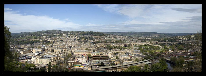
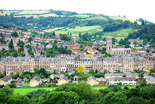
Bath (pronounced /ˈbɑːθ/ or /ˈbæθ/) is a city in the ceremonial county of Somerset in the south west of England. It is situated 97 miles (156 km) west of London and 13 miles (21 km) south-east of Bristol. The population of the city is 83,992.[1] It was granted city status by Royal Charter by Queen Elizabeth I in 1590,[2] and was made a county borough in 1889 which gave it administrative independence from its county, Somerset. The city became part of Avon when that county was created in 1974. Since 1996, when Avon was abolished, Bath has been the principal centre of the unitary authority of Bath and North East Somerset (B&NES).
The city was first established as a spa resort with the Latin name, Aquae Sulis ("the waters of Sulis") by the Romans in AD 43 although verbal tradition suggests that Bath was known before then.[3] They built baths and a temple on the surrounding hills of Bath in the valley of the River Avon around hot springs, which are the only ones naturally occurring in the United Kingdom.[4] Edgar was crowned king of England at Bath Abbey in 973.[5] Much later, it became popular as a spa resort during the Georgian era, which led to a major expansion that left a heritage of exemplary Georgian architecture crafted from Bath Stone.
The City of Bath was inscribed as a World Heritage Site in 1987. The city has a variety of theatres, museums, and other cultural and sporting venues, which have helped to make it a major centre for tourism, with over one million staying visitors and 3.8 million day visitors to the city each year.[6] The city has two universities and several schools and colleges. There is a large service sector, and growing information and communication technologies and creative industries, providing employment for the population of Bath and the surrounding area.
Contents |
History
Celtic and Roman

Archaeological evidence shows that the site of the Roman Baths' main spring was treated as a shrine by the Celts,[7] and was dedicated to the goddess Sulis, whom the Romans identified with Minerva; however, the name Sulis continued to be used after the Roman invasion, leading to the town's Roman name of Aquae Sulis (literally, "the waters of Sulis").[8] Messages to her scratched onto metal, known as curse tablets, have been recovered from the Sacred Spring by archaeologists.[9] These curse tablets were written in Latin, and usually laid curses on people by whom the writer felt they had been wronged. For example, if a citizen had his clothes stolen at the baths, he would write a curse, naming the suspects, on a tablet to be read by the Goddess Sulis Minerva.
The temple was constructed in 60–70 AD and the bathing complex was gradually built up over the next 300 years.[4] During the Roman occupation of Britain, and possibly on the instructions of Emperor Claudius,[10] engineers drove oak piles into the mud to provide a stable foundation and surrounded the spring with an irregular stone chamber lined with lead. In the 2nd century, the spring was enclosed within a wooden barrel-vaulted building,[7] which housed the calidarium (hot bath), tepidarium (warm bath), and frigidarium (cold bath).[11] The city was given defensive walls, probably in the 3rd century.[12] After the Roman withdrawal in the first decade of the 5th century, the baths fell into disrepair and were eventually lost due to silting up.[13]
Post-Roman and Saxon

Bath may have been the site of the Battle of Mons Badonicus (c. 500 AD), where King Arthur is said to have defeated the Saxons, although this is disputed.[14] The Anglo-Saxon Chronicle mentions Bath falling to the West Saxons in 577 after the Battle of Deorham.[15][15] The Anglo-Saxon poem known as The Ruin may describe the appearance of the Roman site about this time. In 675, Osric, King of the Hwicce, set up a monastic house at Bath, probably using the walled area as its precinct.[16] Nennius, a ninth-century historian, mentions a "Hot Lake" in the land of the Hwicce, which was along the Severn, and adds "It is surrounded by a wall, made of brick and stone, and men may go there to bathe at any time, and every man can have the kind of bath he likes. If he wants, it will be a cold bath; and if he wants a hot bath, it will be hot". Bede also describes hot baths in the geographical introduction to the Ecclesiastical History in terms very similar to those of Nennius.[17] King Offa of Mercia gained control of this monastery in 781 and rebuilt the church, which was dedicated to St. Peter.[18] By the 9th century the old Roman street pattern had been lost and Bath had become a royal possession, with King Alfred laying out the town afresh, leaving its south-eastern quadrant as the abbey precinct.[19] Edgar of England was crowned king of England in Bath Abbey in 973.[5] The Anglo-Saxons called the town Baðum, Baðan or Baðon, meaning "at the baths," and this was the source of the present name.
Norman, Medieval and Tudor

King William Rufus granted the city to a royal physician, John of Tours, who became Bishop of Wells and Abbot of Bath in 1088.[20][21] It was papal policy for bishops to move to more urban seats, and he translated his own from Wells to Bath.[22] He planned and began a much larger church as his cathedral, to which was attached a priory, with the bishop's palace beside it.[20] New baths were built around the three springs. However, later bishops returned the episcopal seat to Wells, while retaining the name of Bath in their title as the Bishop of Bath and Wells.
By the 15th century, Bath's abbey church was badly dilapidated and in need of repairs.[23] Oliver King, Bishop of Bath and Wells, decided in 1500 to rebuild it on a smaller scale. The new church was completed just a few years before Bath Priory was dissolved in 1539 by Henry VIII.[24] The abbey church was allowed to become derelict before being restored as the city's parish church in the Elizabethan period, when the city experienced a revival as a spa. The baths were improved and the city began to attract the aristocracy. Bath was granted city status by Royal Charter by Queen Elizabeth I in 1590.[2]
Early modern

During the English Civil War, the Battle of Lansdowne was fought on 5 July 1643 on the northern outskirts of the city.[25] Thomas Guidott, who had been a student of chemistry and medicine at Wadham College Oxford, moved to Bath and set up practice in 1668. He became interested in the curative properties of the waters and he wrote A discourse of Bathe, and the hot waters there. Also, Some Enquiries into the Nature of the water in 1676. This brought the health-giving properties of the hot mineral waters to the attention of the country and soon the aristocracy started to arrive to partake in them.[26]

Several areas of the city underwent development during the Stuart period, and this increased during Georgian times in response to the increasing number of visitors to the spa and resort town who required accommodation.[27] The architects John Wood the elder and his son John Wood the younger laid out the new quarters in streets and squares, the identical façades of which gave an impression of palatial scale and classical decorum.[28] Much of the creamy gold Bath stone which was used for construction throughout the city, was obtained from the limestone Combe Down and Bathampton Down Mines, which were owned by Ralph Allen (1694–1764).[29] Allen, in order to advertise the quality of his quarried limestone, commissioned the elder John Wood to build him a country house on his Prior Park estate between the city and the mines.[29] He was also responsible for improving and expanding the postal service in western England, for which he held the contract for over forty years.[29] Though not fond of politics, Allen was a civic-minded man, and served as a member of the Bath Corporation for many years. He was elected Mayor of the city for a single term, in 1742, at age 50.[29]
The early 18th century saw Bath acquire its first purpose-built theatre, the Theatre Royal, along with the Grand Pump Room attached to the Roman Baths and assembly rooms. Master of Ceremonies Beau Nash, who presided over the city's social life from 1705 until his death in 1761, drew up a code of behaviour for public entertainments.[30]
Late modern
The population of the city had reached 40,020 by the time of the 1801 census, making it one of the largest cities in Britain.[31] William Thomas Beckford bought a house in Lansdown Crescent in 1822, eventually buying a further two houses in the crescent to form his residence. Having acquired all the land between his home and the top of Lansdown Hill, he created a garden over half a mile in length and built Beckford's Tower at the top.[32]
Emperor Haile Selassie I of Ethiopia spent the four years of his exile, from 1936 to 1940, at Fairfield House in Bath.[33] During World War II, between the evening of 25 April and the early morning of 27 April 1942, Bath suffered three air raids in reprisal for RAF raids on the German cities of Lübeck and Rostock, part of the Luftwaffe campaign popularly known as the Baedeker Blitz. Over 400 people were killed, and more than 19,000 buildings were damaged or destroyed.[34] Houses in the Royal Crescent, Circus and Paragon were burnt out along with the Assembly Rooms, while part of the south side of Queen Square was destroyed.[35]
A postwar review of inadequate housing led to the clearance and redevelopment of areas of the city in a postwar style, often at variance with the local Georgian style. In the 1950s the nearby villages of Combe Down, Twerton and Weston were incorporated into Bath to enable the development of further housing, much of it council housing. In the 1970s and 1980s it was recognised that conservation of historic buildings was inadequate, leading to more care and reuse of buildings and open spaces. In 1987 the city was selected as a UNESCO World Heritage Site, recognising its international cultural significance.[36]
Since 2000, developments have included the Bath Spa, SouthGate and the Bath Western Riverside project.[37]
Governance

Historically part of the county of Somerset, Bath was made a county borough in 1889 and hence independent of the newly created administrative Somerset county council.[38] Bath became part of Avon when that non-metropolitan county was created in 1974. Since the abolition of Avon in 1996, Bath has been the main centre of the unitary authority of Bath and North East Somerset (B&NES).[39] Bath remains, however, in the ceremonial county of Somerset, though not within the administrative non-metropolitan county of Somerset.
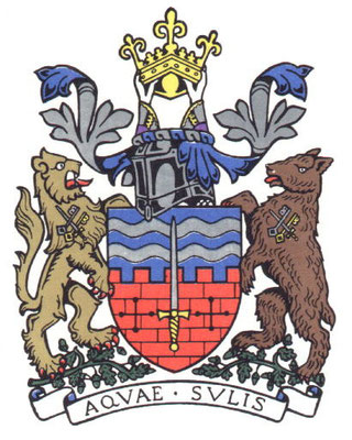
The City of Bath's ceremonial functions, including the mayoralty – which can be traced back to 1230 – and control of the coat of arms, are now maintained by the Charter Trustees of the City of Bath.[40] The coat of arms includes two silver strips, which represent the River Avon and the hot springs. The sword of St. Paul is a link to Bath Abbey. The supporters, a lion and a bear, stand on a bed of acorns, a link to Bladud, the subject of the Legend of Bath. The knight's helmet indicates a municipality and the crown is that of King Edgar.[41]
Before the Reform Act 1832 Bath elected two members to the unreformed House of Commons.[42] Bath now has a single parliamentary constituency, with Liberal Democrat Don Foster as Member of Parliament until the dissolution in 2010. His election was a notable result of the 1992 general election, as Chris Patten, the previous Member (and a Cabinet Minister) played a major part, as Chairman of the Conservative Party, in getting the government of John Major re-elected, but failed to defend his marginal seat in Bath. Don Foster has been re-elected as the MP for Bath in every election since. As of 2010, his majority stands at 11883.[43]
The electoral wards of the Bath and North East Somerset unitary authority within Bath are the central Abbey, Kingsmead and Walcot wards, and the more outlying Bathwick, Combe Down, Lambridge, Lansdown, Lyncombe, Newbridge, Odd Down, Oldfield, Southdown, Twerton, Westmoreland, Weston and Widcombe wards.[44]
Geography
Physical geography
Bath is at the bottom of the Avon Valley, and near the southern edge of the Cotswolds, a range of limestone hills designated as an Area of Outstanding Natural Beauty. The hills that surround and make up the city have a maximum altitude of 238 metres (781 ft) on the Lansdown plateau. Bath has an area of 29 square kilometres (11 sq mi).[45]

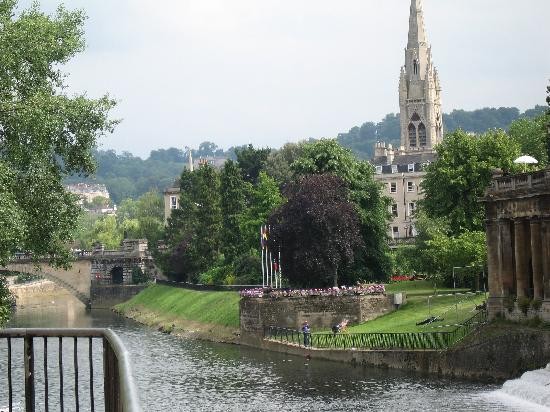
The surrounding hills give Bath its steep streets and make its buildings appear to climb the slopes. The flood plain of the River Avon, which runs through the centre of the city, has an altitude of about 18 metres (59 ft) above sea level.[46] The river, once an unnavigable series of braided streams broken up by swamps and ponds, has been managed by weirs into a single channel. Nevertheless, periodic flooding, which shortened the life of many buildings in the lowest part of the city, was normal until major flood control works in the 1970s.[47]
The water which bubbles up from the ground, as geothermal springs, previously fell as rain on the Mendip Hills. It percolates down through limestone aquifers to a depth of between 2700 and 4300 metres (c. 9000-14,000 ft) where geothermal energy raises the water temperature to between 64 and 96 °C (c. 147-205°F). Under pressure, the heated water rises to the surface along fissures and faults in the limestone. This process is similar to an artificial one known as Enhanced Geothermal System which also makes use of the high pressures and temperatures below the Earth's crust. Hot water at a temperature of 46 °C (115 °F) rises here at the rate of 1,170,000 litres (257,364 imp gal) every day,[48] from a geological fault (the Pennyquick fault). In 1983 a new spa water bore-hole was sunk, providing a clean and safe supply of spa water for drinking in the Pump Room.[49] There is no universal definition to distinguish a hot spring from another geothermal spring, though by several definitions, the Bath springs can be considered the only hot springs in the UK. Three of these springs feed the thermal baths.
Climate
Along with the rest of South West England, Bath has a temperate climate which is generally wetter and milder than the rest of England. The annual mean temperature is about 10 °C (50 °F). Temperature has a seasonal and a diurnal variation, but due to the modifying effect of the sea the range is less than in most other parts of the UK. January is the coldest month with mean minimum temperatures between 1° and 2°C (34°-36°F). July and August are the warmest months, with mean daily maxima around 21 °C (70 °F).[50]
South West England has a favoured location with respect to the Azores High when it extends its influence north-eastwards towards the UK, particularly in summer. Convective cloud often forms inland however, especially near hills, reducing the number of hours of sunshine. The average annual sunshine totals between 1,400 and 1,600 hours.[50]
Rainfall tends to be associated with Atlantic depressions or with convection. The Atlantic depressions are more vigorous in autumn and winter and most of the rain which falls in those seasons in the south-west is from this source. Average rainfall for the Bath-Bristol area is around 800 to 900 millimetres (31 to 35 in).[51] November to March have the highest mean wind speeds, with June to August having the lightest winds. The predominant wind direction is from the south-west.[50]
|
||||||||||||||||||||||||||||||||||||||||||||||||||||||||||||||||||||||||||||||||||||||
Demography

As of 2001 the city of Bath has a population of 83,992.[1] According to the UK Government's 2001 census, Bath, together with North East Somerset, which includes areas around Bath as far as the Chew Valley, has a population of 169,040, with an average age of 39.9 (the national average being 38.6). Demographics shows according to the same statistics, the district is overwhelmingly populated by people of a white ethnic background at 97.2% – significantly higher than the national average of 90.9%. Other ethnic groups in the district, in order of population size, are multiracial at 1%, Asian at 0.5% and black at 0.5% (the national averages are 1.3%, 4.6% and 2.1%, respectively).[52]
The district is largely Christian at 71%, with no other religion reaching more than 0.5%. These figures generally compare with the national averages, though the non-religious, at 19.5%, are significantly more prevalent than the national 14.8%. 7.4% of the population describe themselves as "not healthy" in the last 12 months, compared with a national average of 9.2%; nationally 18.2% of people describe themselves as having a long-term illness, in Bath it is 15.8%.[52]
Culture

Bath became the leading centre of fashionable life in England during the 18th century. It was during this time that Bath's Theatre Royal was built, as well as architectural developments such as Lansdown Crescent,[53] the Royal Crescent,[54] The Circus and Pulteney Bridge.[55]
Today, Bath has five theatres – Bath Theatre Royal, Ustinov Studio, the egg, the Rondo Theatre, and the Mission Theatre – and attracts internationally renowned companies and directors, including an annual season by Sir Peter Hall. The city also has a long-standing musical tradition; Bath Abbey is home to the Klais Organ and is the largest concert venue in the city,[56] with about 20 concerts and 26 organ recitals each year. Another important concert venue is the Forum, a 1,700-seat art deco building which originated as a cinema. The city holds the Bath International Music Festival and Mozartfest every year. Other festivals include the annual Bath Film Festival, Bath Literature Festival (and its counterpart for children), the Bath Fringe Festival and the Bath Beer Festival, and the Bach Festivals which occur at two and a half year intervals.
The city is home to the Victoria Art Gallery,[57] the Museum of East Asian Art, and Holburne Museum of Art,[58] numerous commercial art galleries and antique shops, as well as numerous museums, among them Bath Postal Museum, the Fashion Museum, the Jane Austen Centre, the Herschel Museum of Astronomy and the Roman Baths.[59] The Bath Royal Literary and Scientific Institution, now in Queen Square, and founded in 1824 on the base of a 1777 Society for the encouragement of Agriculture, Planting, Manufactures, Commerce and the Fine Arts, has an important collection and holds a programme of talks and discussions.
Bath in the arts

During the 18th century Thomas Gainsborough and Sir Thomas Lawrence lived and worked in Bath.[60][61] John Maggs, a painter best known for his coaching scenes, was born and lived in Bath with his artistic family.[62] William Friese-Greene began experimenting with celluloid and motion pictures in his studio in Bath in the 1870s, developing some of the earliest movie camera technology there. He is credited as the inventor of cinematography.[63]
Jane Austen lived in the city from 1801 with her father, mother and sister Cassandra, and the family resided in the city at four successive addresses until 1806.[64] However, Jane Austen never liked the city, and wrote to her sister Cassandra, "It will be two years tomorrow since we left Bath for Clifton, with what happy feelings of escape."[65] Despite these feelings, Bath has honoured her name with the Jane Austen Centre and a city walk. Austen's later Northanger Abbey and Persuasion are largely set in the city and feature descriptions of taking the waters, social life, and music recitals. Taking the waters is also described in Charles Dickens' novel The Pickwick Papers in which Pickwick's servant, Sam Weller, comments that the water has "a very strong flavour o' warm flat irons", while the Royal Crescent is the venue for a chase between two of the characters, Dowler and Winkle.[66] Moyra Caldecott's novel The Waters of Sul is set in Roman Bath in 72 AD. Richard Brinsley Sheridan's play The Rivals takes place in the city,[67] as does Roald Dahl's chilling short-story, The Landlady.[68]
Many films and television programmes have been filmed using the architecture of Bath as the backdrop including: the 2004 film of Thackeray's Vanity Fair,[69] The Duchess (2008),[69] The Elusive Pimpernel (1950)[69] and The Titfield Thunderbolt (1953).[69]
In August 2003 the Three Tenors sang at a special concert to mark the opening of the Thermae Bath Spa, a new hot water spa in Bath City Centre; delays to the project meant the spa actually opened three years later on 7 August 2006.
Parks


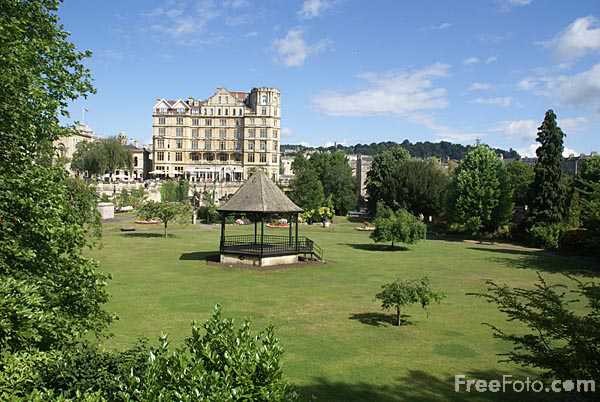
The city has several public parks, the main one being Royal Victoria Park, which is a short walk from the centre of the city. It was opened in 1830 by an 11-year-old Princess Victoria, and was the first park to carry her name.[70] The park is overlooked by the Royal Crescent and is 23 hectares (57 acres) in area.[71] It has a variety of attractions.[72] including a skateboard ramp, tennis courts, bowling, a putting green and a 12- and 18-hole golf course, a pond, open air concerts, and a popular children's play area. Much of its area is lawn; a notable feature is the way in which a ha-ha segregates it from the Royal Crescent, while giving the impression to a viewer from the Crescent of a greensward uninterrupted across the Park down to Royal Avenue. It has received a "Green Flag award", the national standard for parks and green spaces in England and Wales, and is registered by English Heritage as a Park of National Historic Importance.[73] The 3.84 hectares (9.5 acres) botanical gardens were formed in 1887 and contain one of the finest collections of plants on limestone in the West Country.[74] The replica of a Roman Temple was used at the British Empire Exhibition at Wembley in 1924.[75] In 1987 the gardens were extended to include the Great Dell, a disused quarry that was formally part of the park, which contains a large collection of conifers.
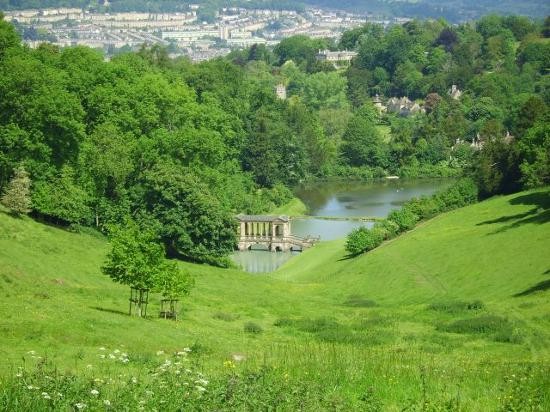
Other parks in Bath include: Alexandra Park, which crowns a hill and overlooks the city; Parade Gardens, along the river front near the Abbey in the centre of the city; Sydney Gardens, known as a pleasure-garden in the 18th century; Henrietta Park; Hedgemead Park; and Alice Park. Jane Austen wrote of Sydney Gardens that "It would be pleasant to be near the Sydney Gardens. We could go into the Labyrinth every day."[76] Alexandra, Alice and Henrietta parks were built into the growing city among the housing developments.[77] There is also a linear park following the old Somerset and Dorset Joint Railway line, and, in a green area adjoining the River Avon, Cleveland Pools were built around 1815.[78] It is now the oldest surviving public outdoor lido in England,[79] and plans have been submitted for its restoration.[80]
Food
Bath has also lent its name to one other distinctive recipe – Bath Olivers – the dry baked biscuit invented by Dr William Oliver, physician to the Mineral Water Hospital in 1740.[83] Oliver was an early anti-obesity campaigner and the author of a "Practical Essay on the Use and Abuse of warm Bathing in Gluty Cases".[83] In more recent years, Oliver's efforts have been traduced by the introduction of a version of the biscuit with a plain chocolate coating. The Bath Chap, which is the salted and smoked cheek and jawbones of the pig, takes its name from the city.[84] It is still available from a stall in the daily covered market. Although there is a brewery named Bath Ales, located a few miles away in Warmley, Abbey Ales are brewed in the city.[85]
Sport
Bath Rugby is a rugby union team which is currently in the Guinness Premiership league and coached by Steve Meehan.[86] It plays in black, blue and white kit at the Recreation Ground in the city, where it has been since the late 19th century, following its establishment in 1865.[87] The team's first major honour was winning the John Player Cup four years consecutively from 1984 until 1987.[88] The team then led the Courage league in six seasons in eight years between 1988/1989 and 1995/1996, during which time it also won the Pilkington Cup in 1989, 1990, 1992, 1994, 1995 and 1996.[88] It finally won the Heineken Cup in the 1997/1998 season, and topped the Zürich Premiership (now Guinness Premiership) in 2003–2004.[88] The team's current squad includes several members who also play in the English national team including: Lee Mears, David Flatman. Nick Abendanon and Matt Banahan. Colston's Collegiate School, Bristol has had a large input in the team over the past decade, providing several current 1st XV squad members. The former England Rugby Team Manager Andy Robinson used to play for Bath Rugby team and was captain and later coach. Both of Robinson's predecessors, Clive Woodward and Jack Rowell, were also former Bath coaches and managers as well as his successor Brian Ashton.
Bath City F.C. is the major football teams. Bath City gained promotion to the Conference National from the Conference South in 2010. Bath City F.C. play their games at Twerton Park.. Until 2009 Team Bath F.C. operated as an affiliate to the University Athletics programme. In 2002, Team Bath became the first university team to enter the FA Cup in 120 years, and advanced through four qualifying rounds to the first round proper.[89] The university's team was established in 1999, while the city team has existed since before 1908 (when it entered the Western League).[90] . However in 2009, the Football Conference ruled that Team Bath would not be eligible to gain promotion to a National division, nor were they allowed to participate in Football Association cup competitions. This ruling led to the decision by the club to fold at the end of the 2008/09 Conference South competition. In their final season, Team Bath F.C. finished a respectable 11th in the league.
Bath City narrowly missed out on election to the Football League in 1985.
Many cricket clubs are based in the city, including Bath Cricket Club, who are based at the North Parade Ground and play in the West of England Premier League. Cricket is also played on the Recreation Ground, just across from where the Rugby is played. The Rec's cricket ground is the venue for the annual Bath Cricket Festival which sees Somerset County Cricket Club play several games. The Recreation Ground is also home to Bath Croquet Club, which was re-formed in 1976 and is affiliated with the South West Federation of Croquet Clubs.[91]
The Bath Half Marathon is run annually through the city streets, with over 10,000 runners.[92] Bath also has a thriving cycling community, with places for biking including Royal Victoria Park, 'The Tumps' in Odd Down/east, the jumps on top of Lansdown, and Prior Park. Places for biking near Bath include Brown's Folly in Batheaston and Box Woods, in Box. Bath is also the home of the Bath American Football Club, which has been playing American Football in the city since 2001.[93]
TeamBath is the umbrella name for all of the University of Bath sports teams, including the aforementioned football club. Other sports for which TeamBath is noted are athletics, badminton, basketball, bob skeleton, bobsleigh, hockey, judo, modern pentathlon, netball, rugby union, swimming, tennis, triathlon and volleyball. The City of Bath Triathlon takes place annually at the university.
Industry
Bath once had an important manufacturing sector, led by companies such Stothert and Pitt. Nowadays manufacturing is in decline in the city, but it boasts strong software, publishing and service-oriented industries, being home to companies such as Future Publishing and London & Country mortgage brokers. The city's attraction to tourists has also led to a significant number of jobs in tourism-related industries. Important economic sectors in Bath include education and health (30,000 jobs), retail, tourism and leisure (14,000 jobs) and business and professional services (10,000 jobs).[6] Its main employers are the National Health Service, the two universities and the Bath and North East Somerset Council, as well as the Ministry of Defence, although a number of MOD offices formerly in Bath have now moved to Bristol. Growing employment sectors include information and communication technologies and creative and cultural industries where Bath is one of the recognised national centres for publishing,[6] with the magazine publisher Future Publishing employing around 650 people. Others include the Helphire Group,[94] an accident management company specialising in non-fault motor accidents (800 jobs), Buro Happold (400) and IPL Information Processing Limited (250).[95] The city contains over 400 retail shops, 50% being run by independent specialist retailers, and around 100 restaurants and cafes which are primarily supported by tourism.[6]
Tourism

One of Bath's principal industries is tourism, with more than one million staying visitors and 3.8 million day visitors to the city on an annual basis.[6] The visits mainly fall into the categories of heritage tourism and cultural tourism. aided by the city's selection in 1987 as a UNESCO World Heritage Site, recognising its international cultural significance.[36] All significant stages of the history of England are represented within the city, from the Roman Baths (including their significant Celtic presence), to Bath Abbey and the Royal Crescent, to Thermae Bath Spa in the 2000s. The size of the tourist industry is reflected in the almost 300 places of accommodation – including over 80 hotels, and over 180 bed and breakfasts – many of which are located in Georgian buildings. The history of the city is displayed at the Building of Bath Collection which is housed in a building which was built in 1765 as the Trinity Presbyterian Church. It was also known as the Countess of Huntingdon's Chapel, as she lived in the attached house from 1707 to 1791.[96] Two of the hotels have 'five-star' ratings.[97] There are also two campsites located on the western edge of the city. The city also contains about 100 restaurants, and a similar number of public houses and bars. Several companies offer open-top bus tours around the city, as well as tours on foot and on the river. Since 2006, with the opening of Thermae Bath Spa, the city has attempted to recapture its historical position as the only town in the United Kingdom offering visitors the opportunity to bathe in naturally heated spring waters.
In the 2010 Google Street View Best Streets Awards, the Royal Crescent took the second place in the "Britain's Most Picturesque Street" award, first place being given to The Shambles in York. Milsom Street was also awarded "Britain's Best Fashion Street" in the 11,000 strong vote.[98][99]
Twinned towns
Bath has five twinned towns:[100]
- Aix-en-Provence, France
- Alkmaar, Netherlands
- Braunschweig, Germany
- Kaposvár, Hungary
- Beppu, Ōita Prefecture, Japan
Bath also has a partnership agreement with Manly, New South Wales, Australia.[100]
Transport
Bath is approximately 13 miles (21 km) south-east of the larger city and port of Bristol, to which it is linked by the A4 road, and is a similar distance south of the M4 motorway. In an attempt to reduce the level of car use Park and Ride schemes have been introduced, with sites at Odd Down, Lansdown and Newbridge, with a Saturdays-only site at the University of Bath. In addition a Bus Gate scheme in Northgate aims to reduce private car use in the city centre.[101] National Express operates coach services from Bath Bus Station to a number of cities. Internally, Bath has a network of bus routes run by First Group, with services to surrounding towns and cities. There is one other company running open top double-decker bus tours around the city.
The city is connected to Bristol and the sea by the River Avon, navigable via locks by small boats. The river was connected to the River Thames and London by the Kennet and Avon Canal in 1810 via Bath Locks; this waterway – closed for many years, but restored in the last years of the 20th century – is now popular with narrowboat users.[102] Bath is on National Cycle Route 4, with one of Britain's first cycleways, the Bristol & Bath Railway Path, to the west, and an eastern route toward London on the canal towpath. Although Bath does not have an airport, the city is about 18 miles (29 km) from Bristol International Airport.
Bath is served by the Bath Spa railway station (designed by Isambard Kingdom Brunel), which has regular connections to London Paddington, Bristol Temple Meads, Cardiff Central, Exeter, Plymouth and Penzance (see Great Western Main Line), and also Westbury, Warminster, Salisbury, Southampton, Portsmouth and Brighton (see Wessex Main Line). Services are provided by First Great Western. There is a suburban station on the main line, Oldfield Park, which has a limited commuter service to Bristol as well as other destinations. Green Park Station was once the terminus of the Midland Railway,[103] and junction for the Somerset and Dorset Joint Railway, whose line, always steam hauled, went under Bear Flat through the Combe Down Tunnel and climbed over the Mendips to serve many towns and villages on its 71-mile (114 km) run to Bournemouth. This example of an English rural line was closed by Beeching in March 1966. Its Bath station building, now restored, houses shops, small businesses, the Saturday Bath Farmers Market and parking for a supermarket, while the route of the Somerset and Dorset within Bath is to be reused for the Two Tunnels Greenway, a shared use path that will extend National Cycle Route 24 into the city.
A tram system was introduced in the late 19th century opening on 24 December 1880. The 4 ft (1,219 mm) gauge cars were horse-drawn along a route from London Road to the Bath Spa railway station, but the system closed in 1902. It was replaced by electric tram cars on a greatly expanded 4 ft 8 1⁄2 in (1,435 mm) gauge system that opened in 1904. This eventually extended to 18 miles (29 km) with routes to Combe Down, Oldfield Park, Twerton, Newton St Loe, Weston and Bathford. There was a fleet of 40 cars, all but 6 being double deck. The first line to close was replaced by a bus service in 1938, and the last went on 6 May 1939.[104]
Architecture
| City of Bath* | |
|---|---|
| UNESCO World Heritage Site | |

|
|
| State Party |
|
| Type | Cultural |
| Criteria | i, ii, iv |
| Reference | 428 |
| Region** | Europe and North America |
| Inscription history | |
| Inscription | 1987 (11th Session) |
|
* Name as inscribed on World Heritage List. ** Region as classified by UNESCO. |
|
There are many Roman archaeological sites throughout the central area of the city, but the baths themselves are about 6 metres (20 ft) below the present city street level. Around the hot springs, Roman foundations, pillar bases, and baths can still be seen, however all the stonework above the level of the baths is from more recent periods.[105]
Bath Abbey was a Norman church built on earlier foundations, although the present building dates from the early 16th century and shows a late Perpendicular style with flying buttresses and crocketed pinnacles decorating a crenellated and pierced parapet.[106] The choir and transepts have a fan vault by Robert and William Vertue.[107] The nave was given a matching vault in the 19th century.[108] The building is lit by 52 windows.[109]

Most buildings in Bath are made from the local, golden-coloured Bath Stone, and many date from the 18th and 19th century. The dominant style of architecture in Central Bath is Georgian;[110] this evolved from the Palladian revival style which became popular in the early 18th century. Many of the prominent architects of the day were employed in the development of the city. The original purpose of much of Bath's architecture is concealed by the honey-coloured classical façades; in an era before the advent of the luxury hotel, these apparently elegant residences were frequently purpose-built lodging houses, where visitors could hire a room, a floor, or (according to their means) an entire house for the duration of their visit, and be waited on by the house's communal servants.[111] The masons Reeves of Bath were prominent in the city from the 1770s to 1860s.
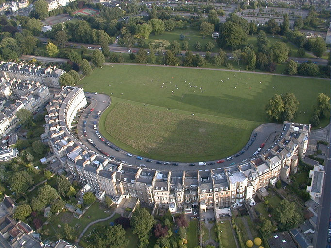
"The Circus" consists of three long, curved terraces designed by the elder John Wood to form a circular space or theatre intended for civic functions and games. The games give a clue to the design, the inspiration behind which was the Colosseum in Rome.[112] Like the Colosseum, the three façades have a different order of architecture on each floor: Doric on the ground level, then Ionic on the piano nobile and finishing with Corinthian on the upper floor, the style of the building thus becoming progressively more ornate as it rises.[112] Wood never lived to see his unique example of town planning completed, as he died five days after personally laying the foundation stone on 18 May 1754.[112]

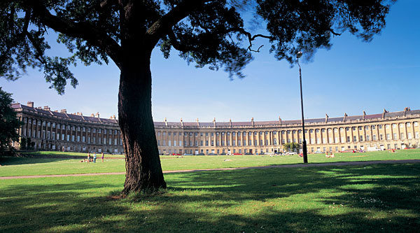
The best known of Bath's terraces is the Royal Crescent, built between 1767 and 1774 and designed by the younger John Wood.[113] But all is not what it seems; while Wood designed the great curved façade of what appears to be about 30 houses with Ionic columns on a rusticated ground floor, that was the extent of his input. Each purchaser bought a certain length of the façade, and then employed their own architect to build a house to their own specifications behind it; hence what appears to be two houses is sometimes one. This system of town planning is betrayed at the rear of the crescent: while the front is completely uniform and symmetrical, the rear is a mixture of differing roof heights, juxtapositions and fenestration. This "Queen Anne fronts and Mary-Anne backs" architecture occurs repeatedly in Bath.[114]
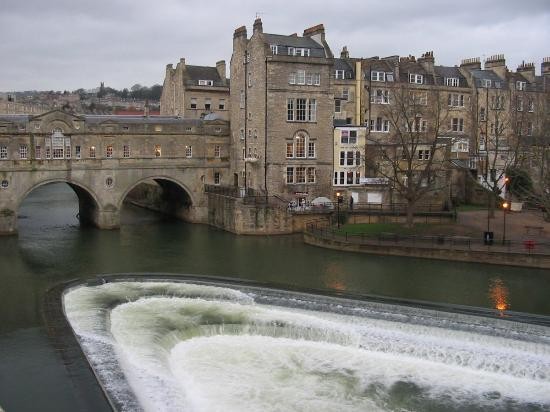
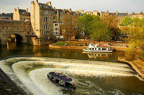
Around 1770 the neoclassical architect Robert Adam designed Pulteney Bridge, using as the prototype for the three-arched bridge spanning the Avon an original, but unused, design by Palladio for the Rialto Bridge in Venice.[115] Thus, Pulteney Bridge became not just a means of crossing the river, but also a shopping arcade. Along with the Rialto Bridge, is one of the very few surviving bridges in Europe to serve this dual purpose.[115] It has been substantially altered since it was built. The bridge was named after Frances and William Pulteney, the owners of the Bathwick estate for which the bridge provided a link to the rest of Bath.[115]
The heart of the Georgian city was the Pump Room, which, together with its associated Lower Assembly Rooms, was designed by Thomas Baldwin, a local builder responsible for many other buildings in the city, including the terraces in Argyle Street,[116] and the Guildhall.[117] Baldwin rose rapidly, becoming a leader in Bath's architectural history. In 1776 he was made the chief City Surveyor, and in 1780 became Bath City Architect.[116] Great Pulteney Street, where he eventually lived, is another of his works: this wide boulevard, constructed circa 1789 and over 1,000 feet (305 m) long and 100 feet (30 m) wide, is lined on both sides by Georgian terraces.
In the 1960s and early 1970s some parts of Bath were unsympathetically redeveloped, resulting in the loss of some 18th- and 19th-century buildings. This process was largely halted by a popular campaign which drew strength from the publication of Adam Fergusson's The Sack of Bath.[118] Controversy has continued in recent years with the demolition of the 1930s Churchill House, a neo-Georgian municipal building originally housing the Electricity Board, to make way for the new Bath Bus Station. The was part of the Southgate redevelopment begun in 2007 in which the central 1960s shopping precinct, bus station and multi-story carpark were demolished and a new area of mock-Georgian shopping streets is being constructed.[119][120] As a result of the changes the city's status as a World Heritage Site was reviewed by Unesco in 2009.[121] The decision was made let Bath keep its status, but Unesco has asked to be consulted on future phases of the Riverside development,[122] saying that the density volume of buildings in the second and third phases of the development need to be reconsidered.[123] It also says that Bath must do more to attract world-class architecture to any new developments.[123]