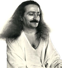
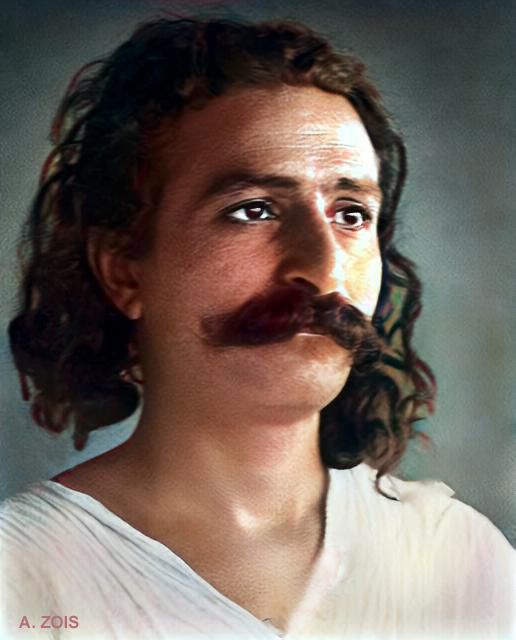
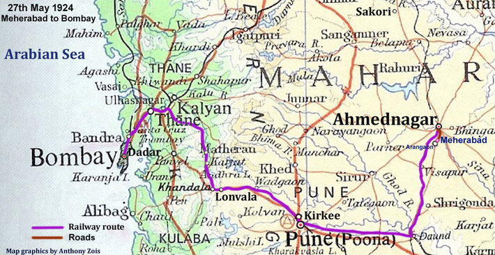
June 1927 - Meherabad, India. Image rendition by Anthony Zois.
British-India flag
1920
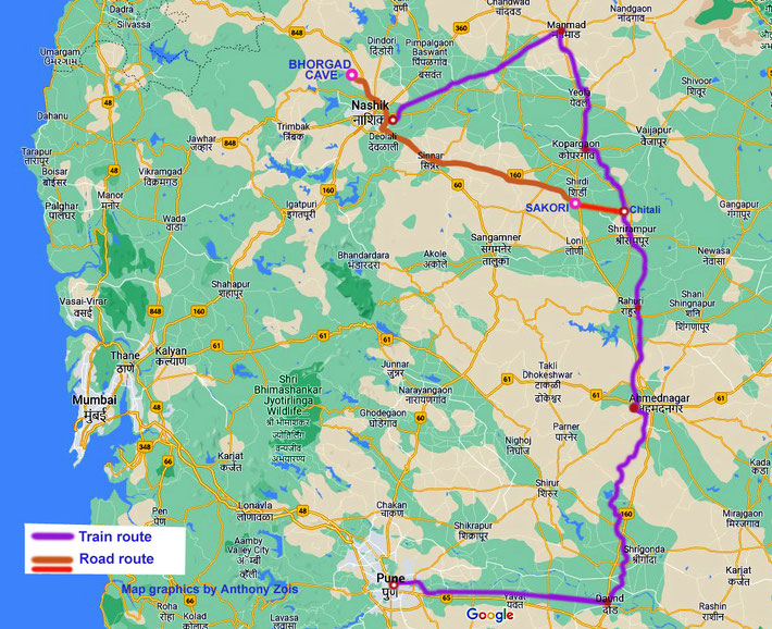
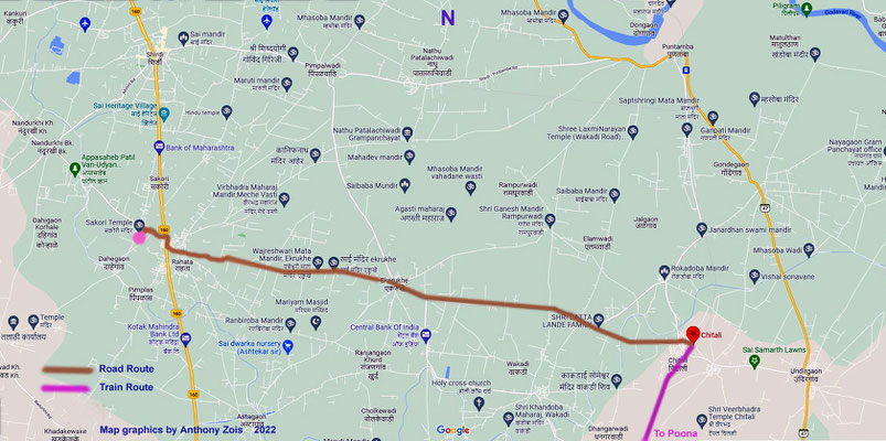
1920 : Map showing the possible train & road routes taken from Sakori to Nasik & return, also to Poona. Map graphics by Anthony Zois.
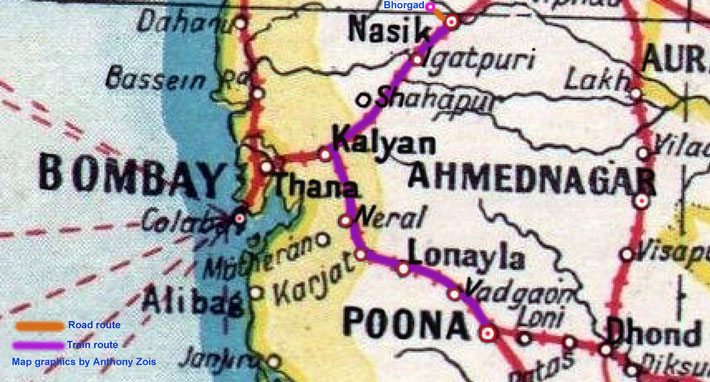
1920 : Map showing the train route from Poona to Nasik. Map graphics by Anthony Zois.
1920 : The map shows the 2 railway routes of travelling from Bombay to Sakori. Map graphics by Anthony Zois.
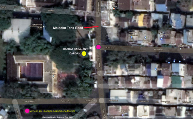
Map of 1920 : Bombay / Mumbai showing the dirct road route from Charni Rd to Null Bazaar - Ghani's dispensary
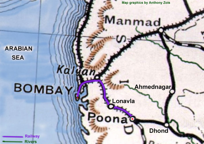
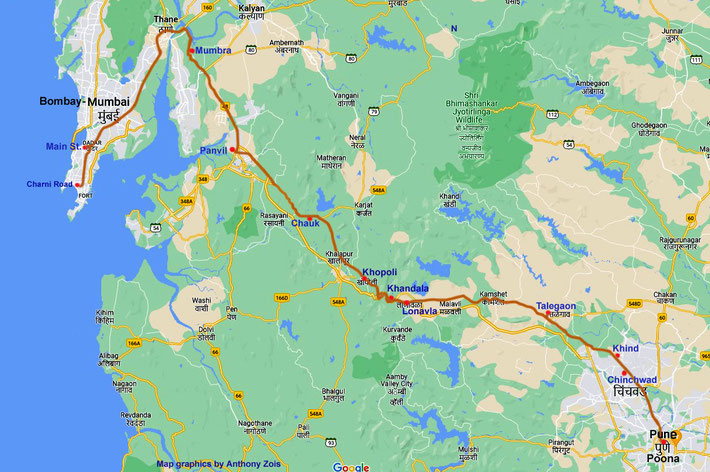
1920s : The rail journey between Bombay & Poona. Map graphics by Anthony Zois.
1922
May 21st 1922 - Map : Poona to Talegaon road journey. Map graphics by Anthony Zois.
Late May 1922 : Map showing the route that Meher Baba & his male followers took from Poona to Bombay. Map graphics by Anthony Zois.
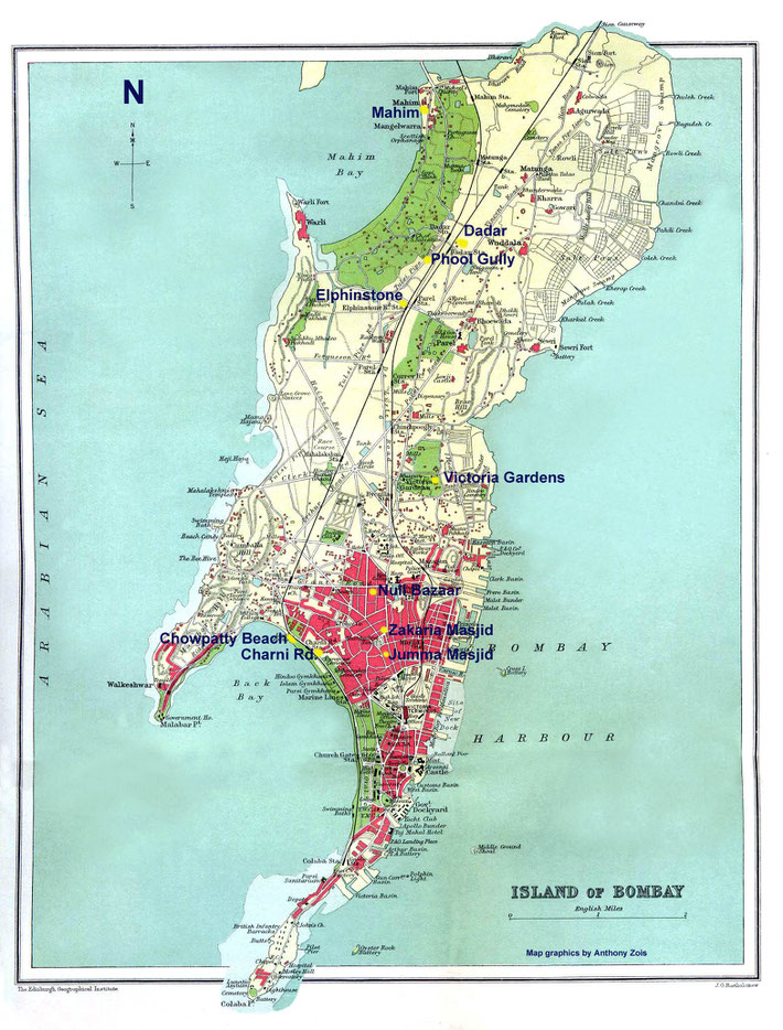
Map of Bombay showing the 2 principal places used by Meher Baba also the Tomb of Abdur Rehman in 1922. Map graphics by Anthony Zois.
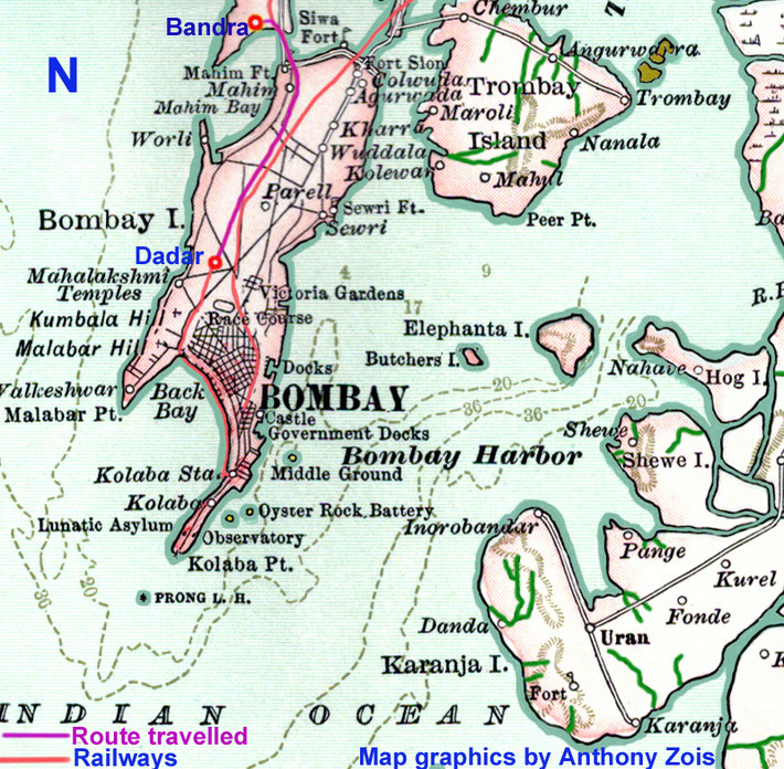
1922 : Trip from Dadar to Bandra map. Map graphics by Anthony Zois.
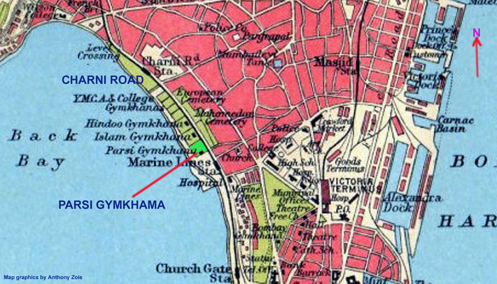
1922 : Map showing the location of Charni Road & the Parsi Gymkhana grounds in Bombay.
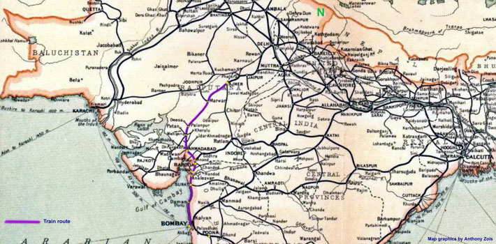
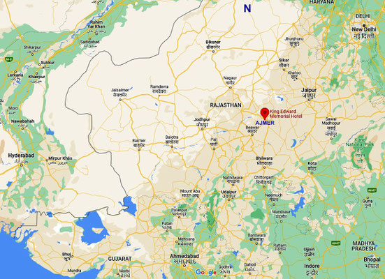
1922 : Bombay to Amjer rail journey. Map graphics by Anthony Zois.
1922 October visit - Bombay to Sakori, then to Ahmednagar - Poona - Bombay. Map graphics by Anthony Zois.
1923
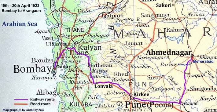
19-20th April 1923 : Bombay to Arangaon via Poona. Map graphics by Anthony Zois.
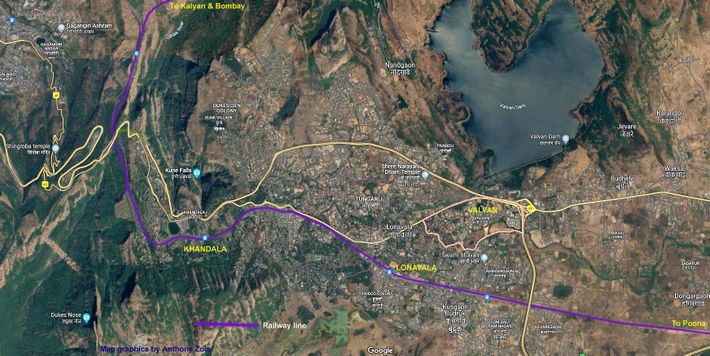
Map shows the Lonavala greater area & rail line which Meher Baba used. Map graphics by Anthony Zois.
Map of Meherabad as it was in 1923, when Baba first came. Drawn by Elaine Cox, courtesy of AMB Trust Archives, India.
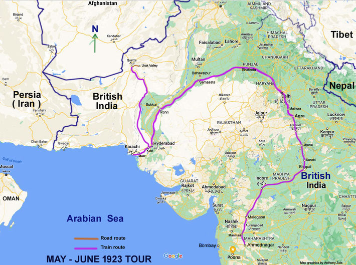
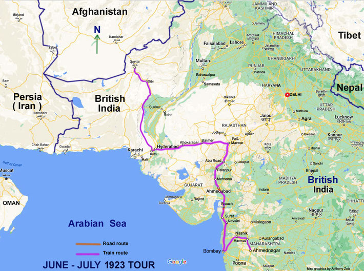
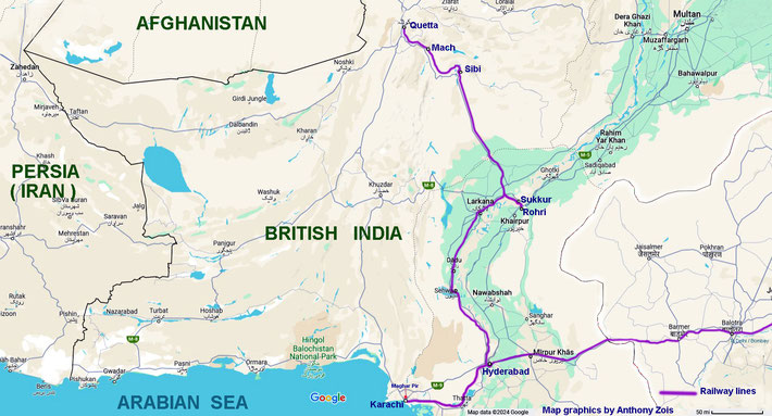
May - July 1923 : Area covered by Meher Baba and his companions, from Meherabad to Quetta & return. Map graphics by Anthony Zois.
May - June 1923 map route - Ahmednagar to Quetta, Br. India. Map graphics by Anthony Zois.
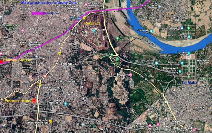
27th May 1923 : Map of Agra, India. Map graphics by Anthony Zois.
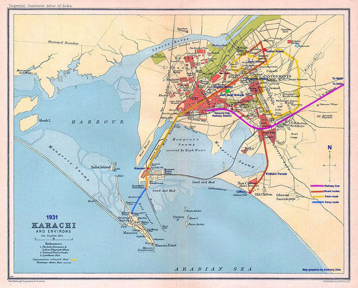
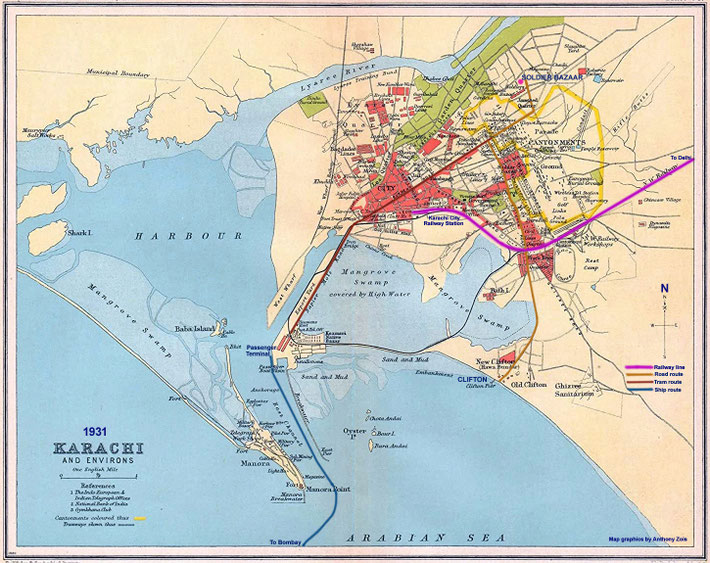
1931 : Map of Karachi, British India. Map graphics by Anthony Zois.
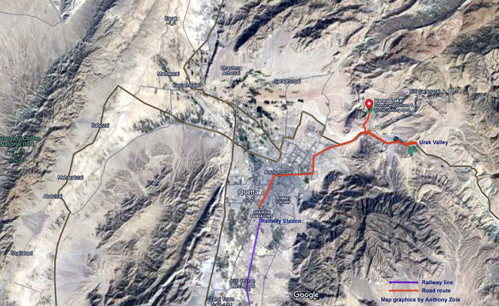
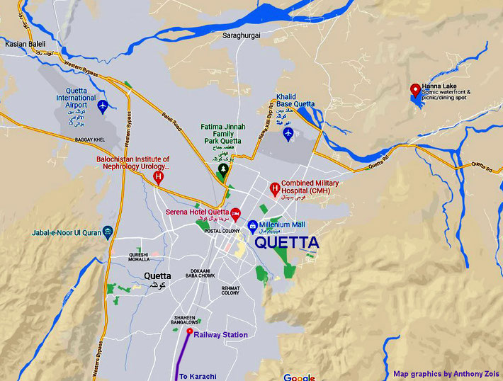
1923 : Map of Quetta district showing Hanna Lake & Urak Valley that Baba visited. Map graphics by Anthony Zois.
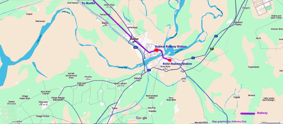
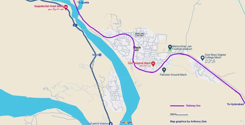
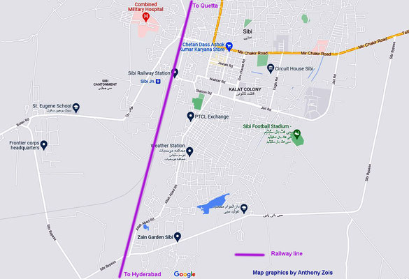
June - July 1923 : Quetta to Meherabad route taken. Map graphics by Anthony Zois.
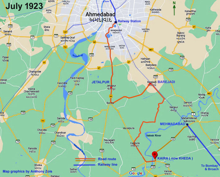
1st - 2nd July 1923 : Meher Baba & his men mandali walking trip from Ahmedabad to Mehmadabad. Map graphics by Anthony Zois.
Map shows the various walking routes between Ahmedabad & Navsari. Map graphics by Anthony Zois.
The Bombay map shows the rail line from Navsari to Dadar & then they changed to the Dadar to Nasik line. Map graphics by Anthony Zois.
This map shows the next part of the journey from Dadar Station, Bombay to Nasik, then to Ahmednagar and then return to Dadar the same way. Map graphics by Anthony Zois.
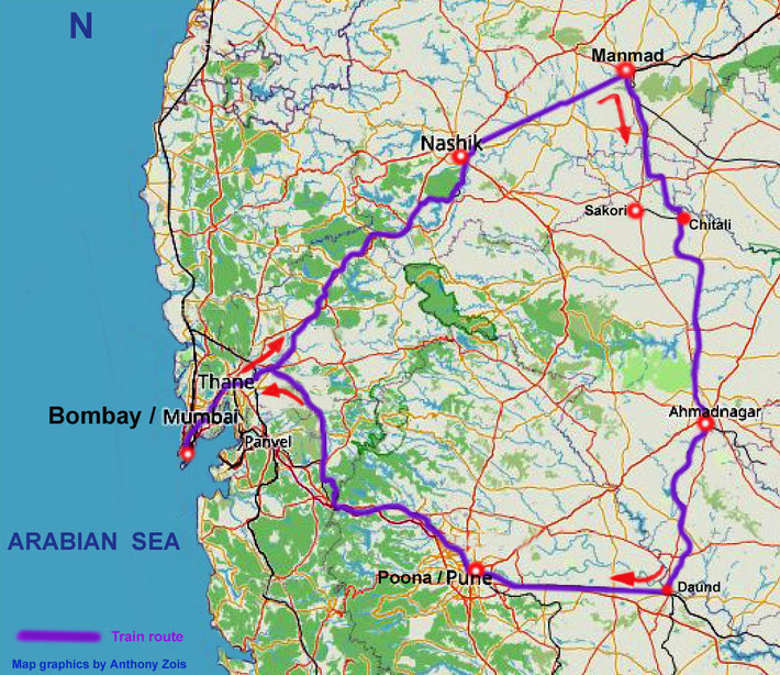
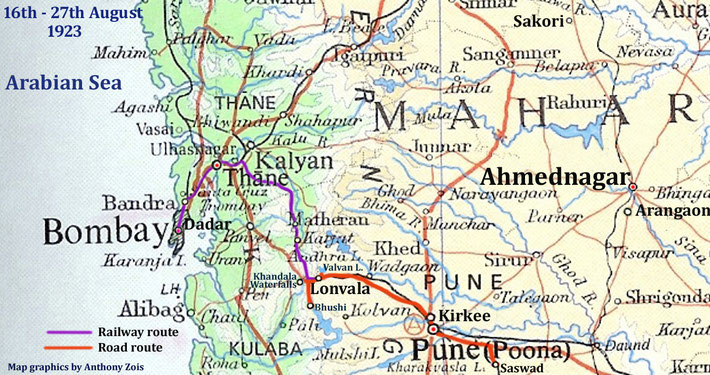
16th-27th Aug. 1923 : Bombay to Lonvala & Poona. Map graphics by Anthony Zois.
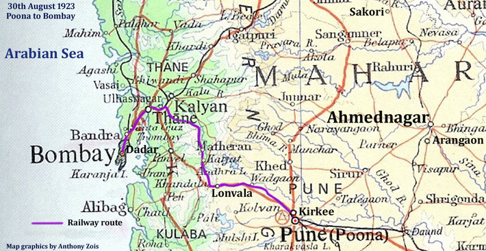
30th August 1923 : Poona to Bombay. Map graphics by Anthony Zois.
19th Oct. - 2nd Nov. 1923 - Walking tour : Bombay to Sakori, then truck to Ahmednagar. Map graphics by Anthony Zois.
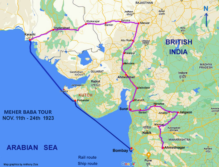
11th Nov. 1923 Tour. Map graphics by Anthony Zois.
14th-22nd November 1923. Map shows the various routes taken in Karachi, prior to sailing to Bombay. Map graphics by Anthony Zois.
24th Nov. 1923 : Trip from Bombay to Sholapur, then to Arangaon. Map graphics by Anthony Zois.
1924
FEB.- MARCH TOUR
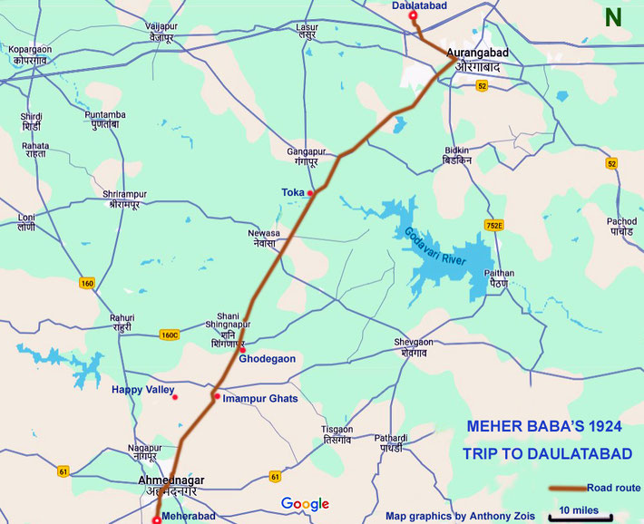
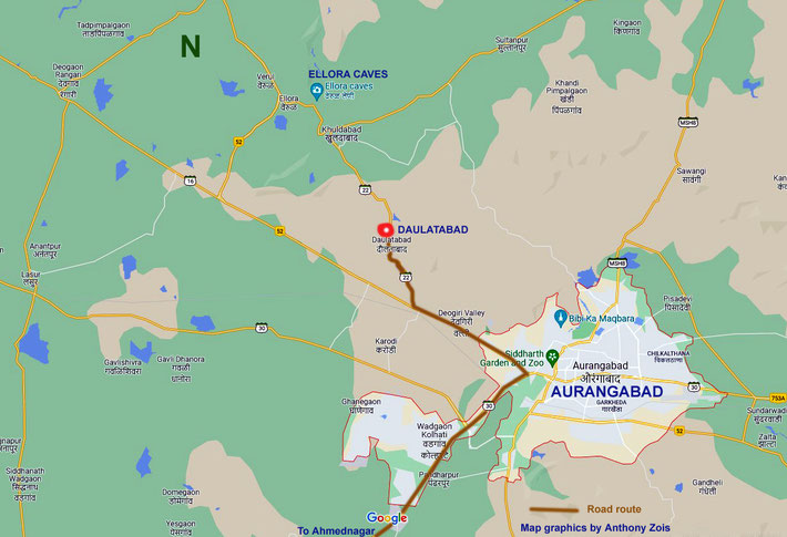
JUNE - JULY 1924 TOUR
1924 June - Ist part of the tour route - Ahmednagar to Daman, India.
1924 AUGUST to DECEMBER
The map shows all the trips Meher Baba made from Aug. to Dec. 2024. Map graphics by Anthony Zois.
1924 AUGUST
1924 11-12th AUGUST
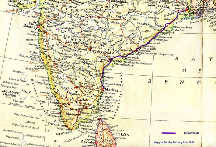
Map shows the Train route from Madras to Howrah, West Bengal State. Map graphics by Anthony Zois.
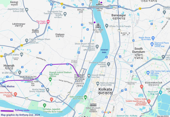
Map showing parts of Howrah & Calcutta. Map graphics by Anthony Zois.
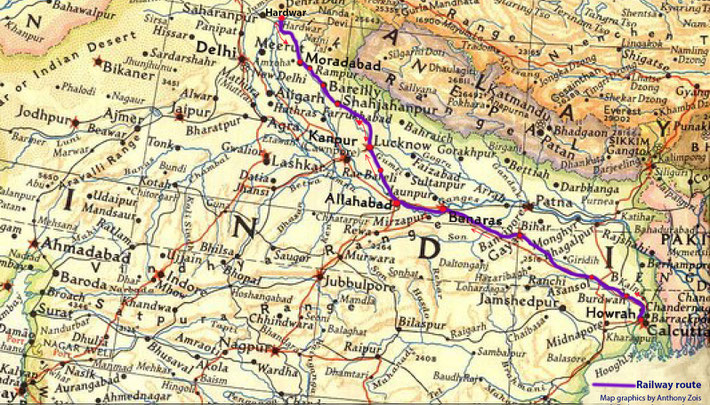
Map shows the train route from Howrah to Hardwar. Map graphics by Anthony Zois.
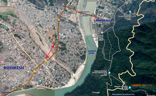
Maps shows the road route from Hardwar Railway Station to Rishikesh. Map graphics by Anthony Zois.
Satellite map showing the path they walked from Hardwar & Pathri, then by train to Moradabad. Map graphics by Anthony Zois.
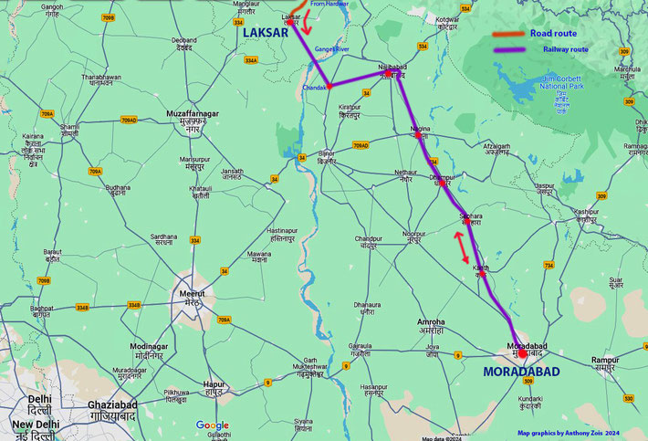
Map shows the rail route from Laksar to Moradabad. Map graphics by Anthony Zois.
Map shows the next stage of the rail journey between Moradabad & Lucknow. Map graphics by Anthony Zois.
Map shows the continuing train journey from Lucknow to Jhansi. Map graphics by Anthony Zois.
Map show the train journey continuing from Jhansi to Bhopal, Ujjain & Ratlam. Map graphics by Anthony Zois.
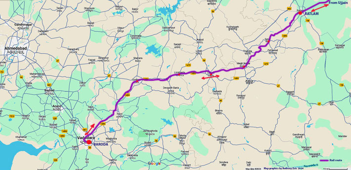
Map shows the rail journey between Ratlam & Baroda. Map graphics by Anthony Zois.
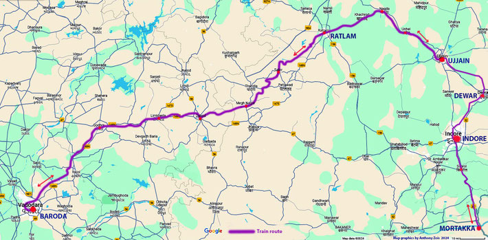
Map shows the rail journey from Baroda to Ujjain, then to Indore & Mortakka. Map graphice by Anthony Zois.
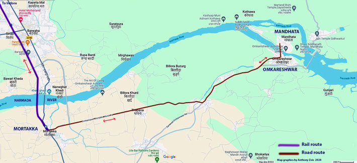
Map show the train line from Ujjain & the road to Omkareshwar & Mandhata. Map graphics by Anthony Zois.
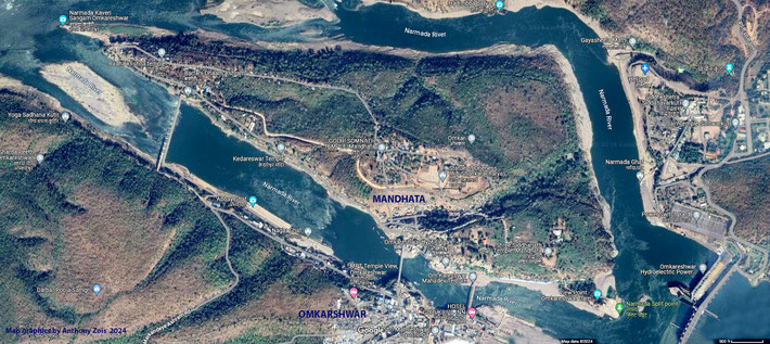
An aerial view of Mandhata Island. Map graphics by Anthony Zois.
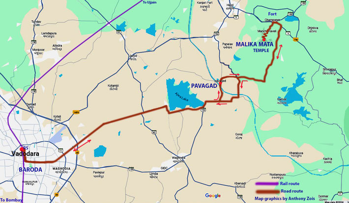
Map shows rail & road routes to Pavagad Hill temples. Map graphics by Anthony Zois.
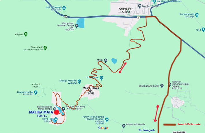
Map is a close up of the Pavagarh Hill Temple area. Map grathics by Anthony Zois.
1924 Map shows the final stage - Baroda to Bombay, of his huge India trip. Map graphics by Anthony Zois.
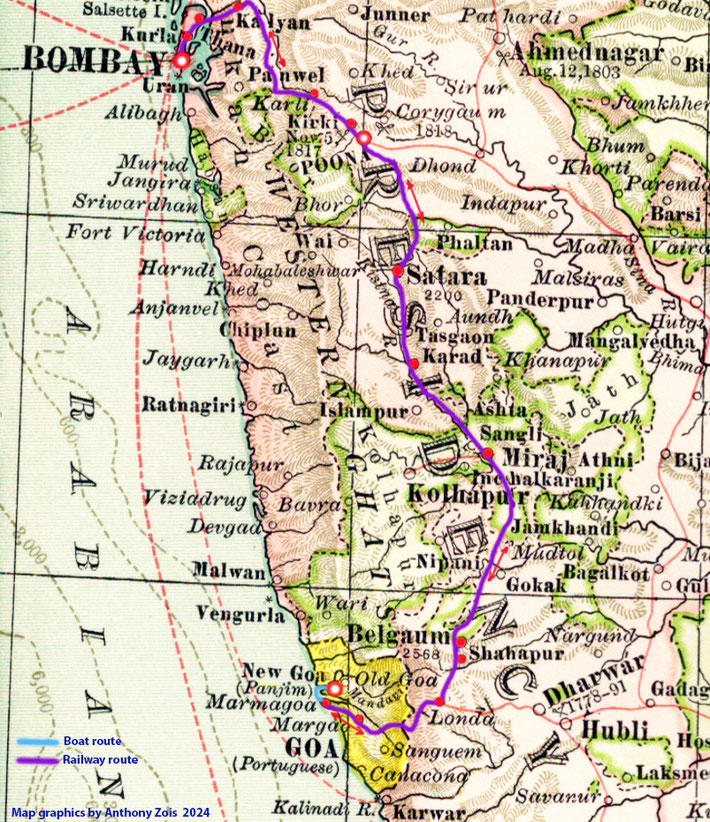
The map shows the rail route from Bombay to Marmagoa, Goa via Poona. Map graphics by Anthony Zois.
Map shows the various routes taken to get to Panjim, Goa. Map graphics by AnthonyZois.
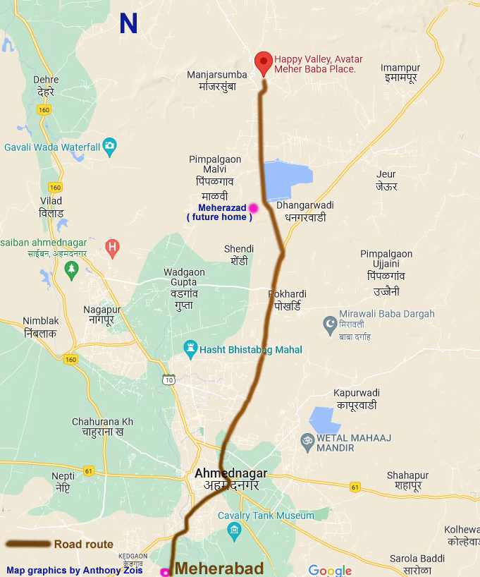
Map shows the rail route takem between Bombay & Ahmednagar, then by road to Meherabad. Map graphics by Anthony Zois.
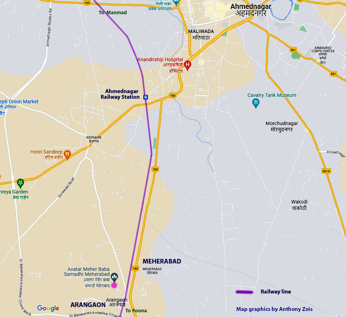
Present-day map shows Ahmednagar with Meherabad & Arangaon nearby. Map graphics by Anthony Zois.
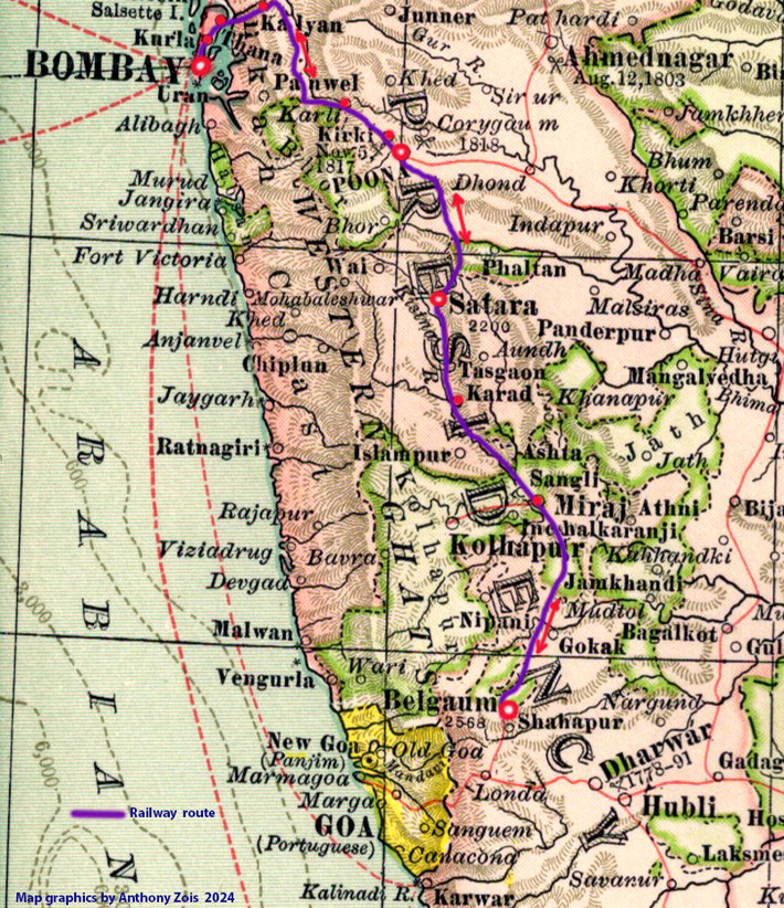
Map shows the rail route from Bombay to Belgaum via Poona. Map graphics by Anthony Zois.
1924 : Map shows all the trips made within Br. India. Most started from Bombay. Map graphics by Anthony Zois.

 Meher Baba's Life & Travels