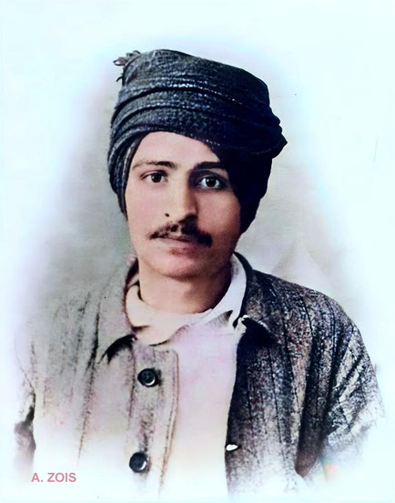
Merwan S. Irani ( later Meher Baba ) in 1918-'19. Image rendition by Anthony Zois.
British-India flag
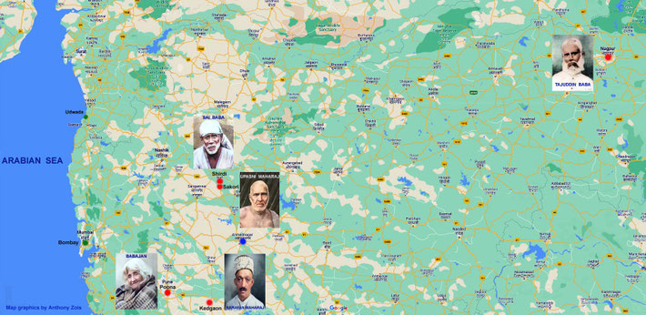
Location of the 5 Perfect Masters in India. Map graphics by Anthony Zois.
1914 Map of Poona showing the important locations for Merwan Irani ( later Meher Baba ). Map graphics by Anthony Zois.
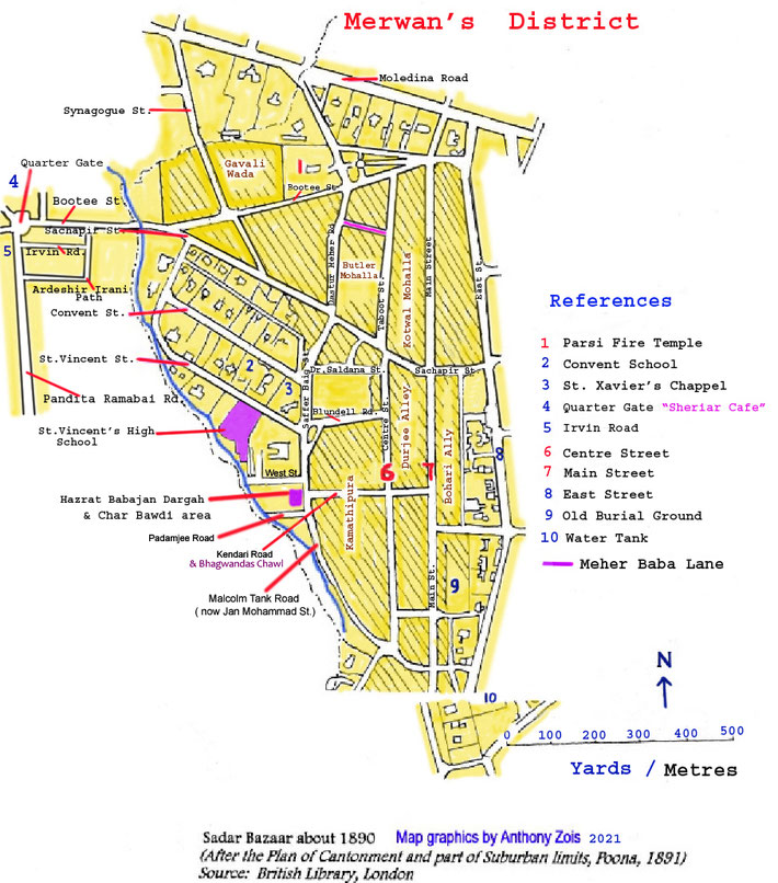
Map 2 : Merwan Irani's localised Poona district in the mid-1890s. Map graphics by Anthony Zois.
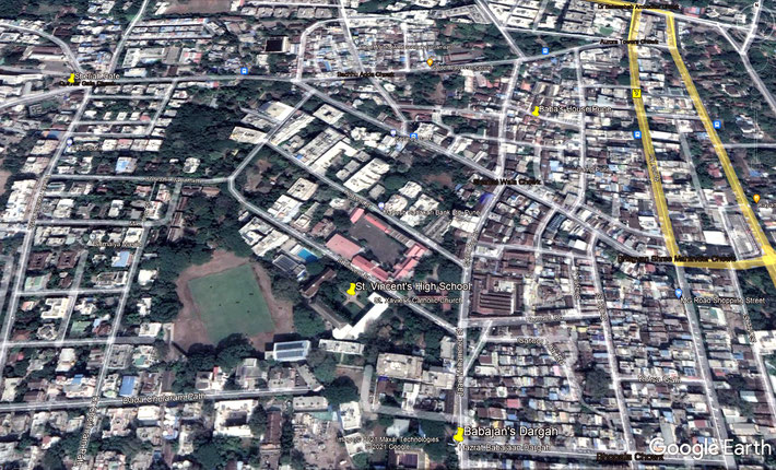
Map 6 : Present-day aerial map of Pune showing important places for Meher Baba marked by yellow markers. Map grahics by Anthony Zois.
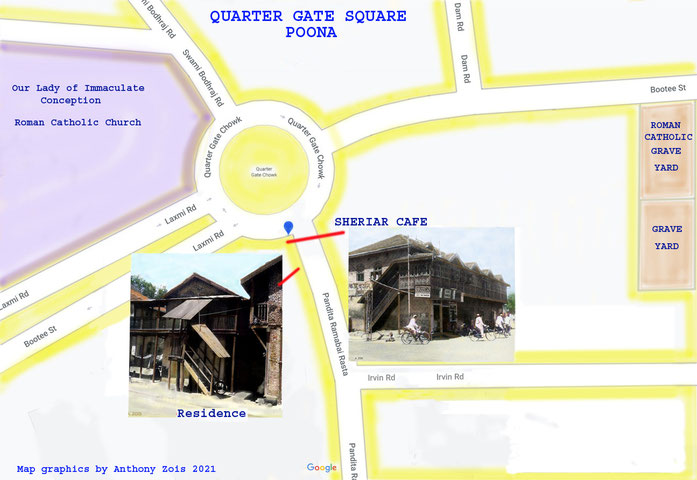
Map 7 : 1900 Quarter Gate Square, Poona. Map graphics by Anthony Zois.
Map shows the route Merwan took first by train from Poona to Kedgaon then by foot to Narayan Maharaja's temple. Map graphics by Anthony Zois.
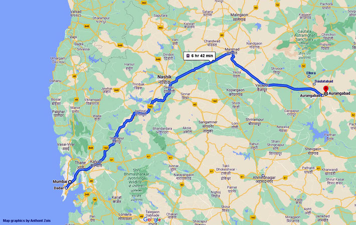
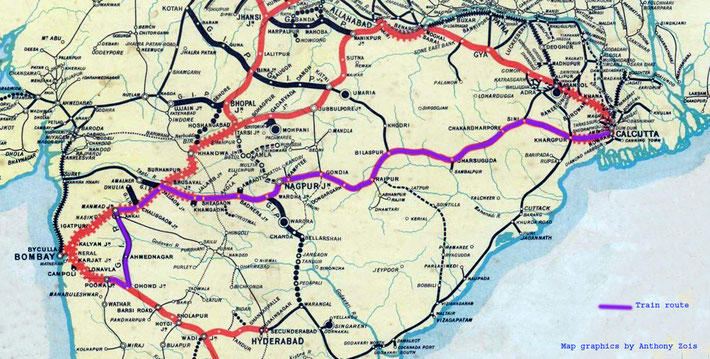
Map : Train route Bombay to Aurangabad. Map graphics by Anthony Zois.
MERWAN meets TAJUDDIN BABA
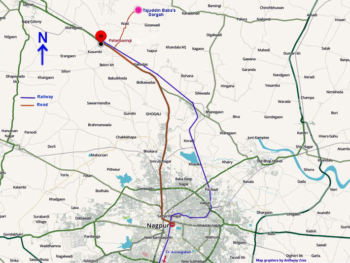
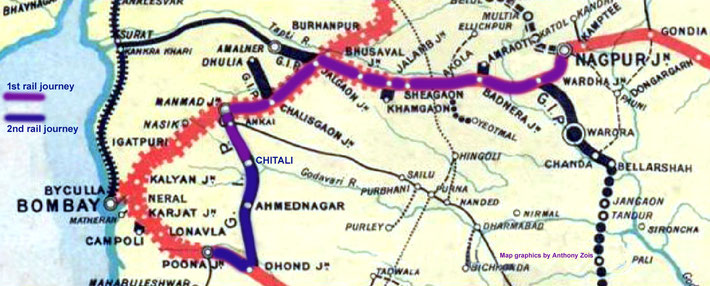
Nagpur : Map showing both the train & road routes to Patansaongin then to Tajuddin Baba's Waki Dargah. Map graphics by Anthony Zois.
1902 Map showing 4 of the 5 Perfect Masters locations. Map graphics by Anthony Zois.
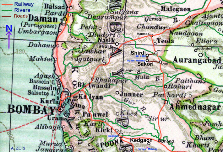
Map shows the rail & road routes Merwan took from Poona ( Pune ) to Shirdi. Map graphics by Anthony Zois.
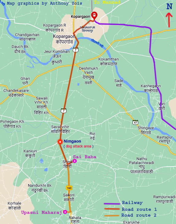
Map showing Kapargaon Railway Station & roads leading to Shirdi. Map graphics by Anthony Zois.
Map showing the final leg of the train route to Kopargaon, the nearest railway station to Shirdi & the road route to Shirdi from the railway station. Map graphics by Anthony Zois.
Map shows close-up of present-day Shirdi with the road route between Sai Baba's temple & Khandoba Mandir. Map graphics by Anthony Zois.
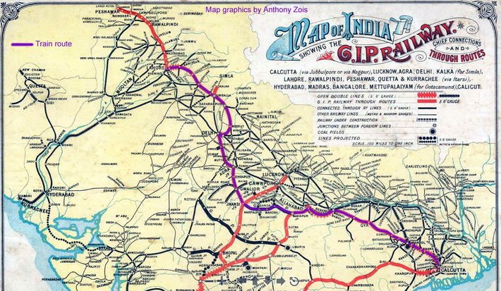
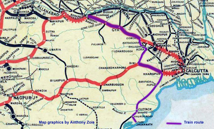
1915 Train route in purple : Poona to Calcutta. Map graphics by Anthony Zois.
1913 Map showing the rail route from Calcutta to Lahore. Map graphics by Anthony Zois.
Map showing the dog attack area at Nimgaon. Other references refer to it as Limbgaon- it's incorrect. Map graphics by Anthony Zois.
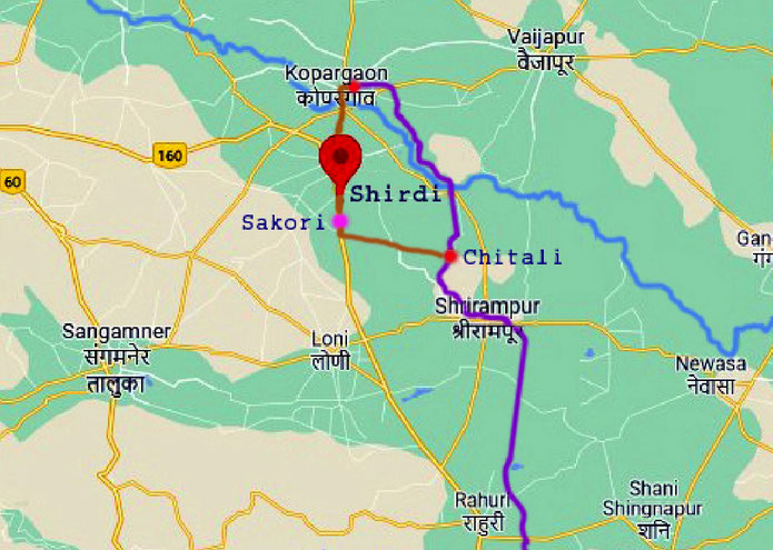
Map showing the close-up of the Shirdi-Sakori area. Map graphics by Anthony Zois.
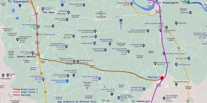
Map showing the railway & road routes to Sakori. Map graphics by Anthony Zois.
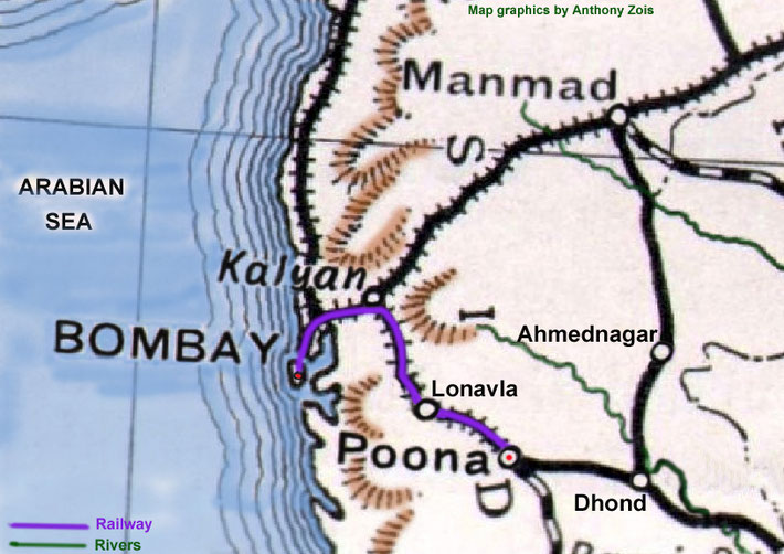
Map showing the rail route from Poona to Bombay. Map graphics by Anthony Zois.
1911 Map shows the rail route taken from Belapur to Benares - marked in purple. Map graphics by Anthony Zois.
1911 Map shows the rail route between Benares and Jagannath Puri. Map graphics by Anthony Zois.
Map shows the rail route between Jagannath Puri & Khargpur. Map graphics by Anthony Zois.

 Meher Baba's Life & Travels